NOAA has released its 2026 hurricane season forecast, and the headline is unexpected: a below-normal Atlantic season with 8 to 13 named storms. But as forecasters are quick to warn, a quiet outlook does not mean a safe summer.
NOAA released its 2026 hurricane season forecast in May, and for the first time in several years, the outlook calls for below-normal activity. But a quiet forecast does not mean a safe summer.
What’s Happening
The first seasonal outlook of the 2026 Atlantic hurricane season arrived in late May, and for once, it brought something close to good news. NOAA expects a below-normal season. The numbers are lower than they have been in several years. But anyone who lives along the Gulf or Atlantic coasts knows that a quiet forecast is not the same thing as a safe summer.
NOAA’s May 21 outlook calls for 8 to 13 named storms, 4 to 7 hurricanes, and 1 to 3 major hurricanes of Category 3 or higher. A typical Atlantic season produces 14 named storms. On June 10, Colorado State University lowered its forecast further to 11 named storms, 5 hurricanes, and 2 major hurricanes, with an Accumulated Cyclone Energy index near 70.
2026 Hurricane Season Forecast Comparison
| Forecast | Named Storms | Hurricanes | Major Hurricanes |
|---|---|---|---|
| NOAA (May 21) | 8–13 | 4–7 | 1–3 |
| CSU (June 10) | 11 | 5 | 2 |
| Average Season | 14 | 7 | 3 |
Sources: NOAA Climate Prediction Center, Colorado State University Tropical Meteorology Project
Tropical Storm Arthur did not wait for the numbers to settle. On June 17, the first named storm of the 2026 season formed in the Gulf of Mexico and pushed flooding into communities from the Florida Panhandle to Louisiana. The storm was moderate by most measures, but the flooding it carried sent a clear message: a season’s total storm count says nothing about whether your town floods. For more on that unfolding event, read our coverage of Tropical Storm Arthur’s aftermath.
Why It’s Happening
The below-normal forecast is driven largely by one word: El Nino. The World Meteorological Organization puts the odds of an El Nino developing during 2026 at roughly 80 percent, and forecasters expect it to reach moderate or strong intensity by the peak of hurricane season in September.
El Nino is a warming of the eastern tropical Pacific Ocean that reshapes weather patterns around the globe. In the Atlantic basin, its signature effect is increased wind shear: strong upper-level winds that can tear apart developing tropical cyclones before they organize. For a deeper look at how El Nino works and why it matters for hurricane forecasts, see our complete guide to El Nino.
It only takes one storm to make for a very bad season.
Ken Graham, NOAA National Weather Service Director
A second factor is also at work. Sea surface temperatures in the tropical Atlantic ran slightly cooler than average during May, reducing the heat energy available to fuel storms. But ocean temperatures can shift quickly as summer progresses, and the Gulf of Mexico remains well above the 80-degree-Fahrenheit threshold needed to sustain tropical systems. For a breakdown of how hurricanes form over warm water, read our Hurricanes 101 explainer.
How It Affects People
The Danger of a Quiet Forecast
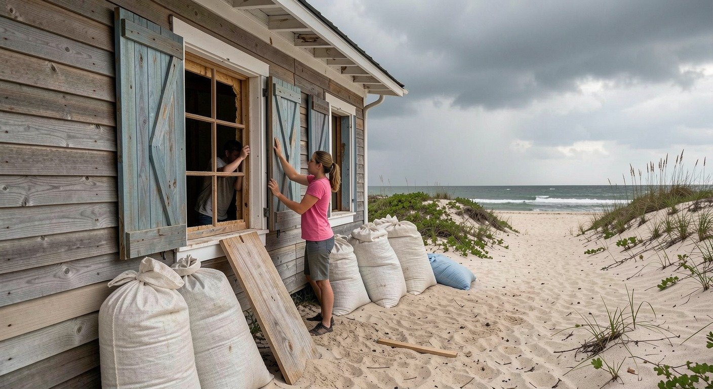
A below-normal forecast can produce a dangerous kind of complacency. When headlines emphasize fewer storms, the instinct is to relax. Coastal residents who have lived through active seasons may decide that this is the year to skip flood insurance or put off replacing old storm shutters. That instinct has real consequences.
In 1992, the Atlantic produced just seven named storms. The season was classified as below normal. One of those seven storms was Hurricane Andrew, which struck South Florida as a Category 5 and became the costliest hurricane in U.S. history at the time.
It takes exactly one storm hitting exactly the wrong place. The number of storms in a season is a statistic. The storm that hits your town is a disaster.
Arthur’s Early Warning
Tropical Storm Arthur is this season’s living example. The storm never reached hurricane strength. Its winds were modest. But its flooding swamped streets in Galveston, Texas, and the National Hurricane Center issued rare inland flood warnings that stretched across the Southeast. A quiet season still produced a damaging storm before summer officially began.
Insurance and Preparedness Gaps
Standard homeowners insurance policies do not cover flood damage. Separate flood insurance through the National Flood Insurance Program carries a 30-day waiting period before coverage takes effect. Waiting until a storm is named is waiting too long. A family that delays until a forecast turns threatening has already missed the window. Renters are even more exposed.
The public messaging around a quiet season can inadvertently work against preparation. When NOAA says “below normal,” many people hear “don’t worry.” The agencies themselves are careful to add caveats. But the caveats rarely survive the journey from a press release to a headline to a kitchen-table conversation.
Why It Matters Now
The 2026 hurricane season is unfolding in an ocean that is fundamentally different from the one that produced Hurricane Andrew three decades ago. According to NOAA’s seasonal outlook, oceans globally have absorbed more than 90 percent of the excess heat trapped by greenhouse gases.
Warmer oceans do not necessarily produce more storms. But they can make the storms that do form intensify faster. Research has documented a rise in rapid intensification events, cases where a storm’s maximum sustained winds jump by 35 miles per hour or more in 24 hours. A tropical storm that looks manageable on Monday can reach major hurricane strength by Wednesday, leaving coastal communities with dramatically less time to evacuate.
El Nino’s wind shear suppresses the number of storms. Warmer oceans raise the ceiling for the ones that survive. The two forces are in tension, and the result is genuine uncertainty. A season with fewer storms is still a season that can produce a monster.
What You Can Do
Preparation does not require panic. It requires a checklist. The Atlantic hurricane season runs from June 1 through November 30. Everyone living within 50 miles of the coast benefits from knowing their evacuation zone, having a go-bag with three days of food and water, and securing flood insurance before the 30-day waiting period becomes a problem.
- Know your zone. Find your evacuation zone and at least two ways out of your neighborhood.
- Build a go-bag. Three days of non-perishable food, one gallon of water per person per day, medications, phone charger, N95 masks.
- Get flood insurance now. NFIP policies take 30 days to activate. Do not wait for a named storm.
- Check on neighbors. Seniors and people with disabilities may need help evacuating.
- Have multiple alert sources. Wireless Emergency Alerts, NOAA Weather Radio, and a trusted weather app.
The 2026 forecast is welcome news. Lower numbers mean lower odds. But odds are not guarantees. The Atlantic has produced devastating hurricanes during quiet seasons before. It will almost certainly do so again. The question is not whether a storm will eventually test your community. It is whether you are ready when it does.
For the latest tropical outlooks and active storm tracking, visit the National Hurricane Center. Real-time flood risk data is available from the NOAA National Water Prediction Service.
A quiet season still needs a plan. Start with our 2026 hurricane preparation guide.