On July 2, 2026, the southwest monsoon finally reached Delhi. For millions of residents across northern India, the first rain brought relief from weeks of scorching heat that had pushed temperatures past 45°C in some districts. The monsoon season 2026 arrived later than expected, carrying a troubling forecast from the India Meteorological Department: below-normal rainfall for July, the most critical month for India’s rain-fed agriculture.
The story is different across Southeast Asia. While India braces for deficits, coastal Myanmar and parts of Thailand face the opposite problem. Forecasters warn of above-normal rainfall through September. The same monsoon system that is underwhelming in one region is threatening floods in another.
The Monsoon Season 2026 So Far: India’s Patchy Start
The monsoon season 2026 opened with a significant shortfall. June ended with a 40 percent rainfall deficit countrywide, according to the India Meteorological Department. The monsoon made up some ground after June 29. It covered Delhi by July 2 and advanced across much of central and northern India.
The catch-up has been uneven. A low-pressure area formed over West Bengal in mid-July. It began dumping heavy rainfall on Chhattisgarh and Odisha. The IMD warned on July 17 that these regions face continued heavy precipitation in the days ahead. Some areas are now dealing with too much water. Others remain dry.
This patchiness was exactly what the IMD’s long-range forecast predicted. In May 2026, the agency projected the southwest monsoon would reach only 94 percent of its long-period average (LPA). The forecast emphasized uneven distribution as a central concern. The first half of July has confirmed that outlook. Higher daytime and nighttime temperatures are compounding the rainfall deficit, as DownToEarth reported in its analysis of the IMD’s July bulletin.
The Numbers: Below Average, But Not Everywhere
The IMD’s July forecast points to below-normal rainfall across the country alongside elevated temperatures. Indian agriculture depends heavily on July rains. This is when farmers plant kharif crops. Rice goes into the ground. Pulses get sown. Cotton fields take their first water. A dry July means delayed sowing. Delayed sowing means smaller harvests.
The long-range forecast pegs the full season at 94 percent of the LPA. In a normal year, India receives about 87 centimeters of monsoon rain from June through September. A 6 percent deficit may sound modest. The uneven distribution makes the headline number misleading. Some states could receive near-normal rainfall. Others could face serious shortfalls.

The current low-pressure system illustrates the unevenness. West Bengal and the central Indian belt are now receiving intense rain. Northwestern states like Punjab and Rajasthan have seen below-normal accumulation since June 1.
Across Southeast Asia, the ASEAN Specialised Meteorological Centre paints a different picture. The July-to-September 2026 outlook forecasts above-normal rainfall over coastal and southern Myanmar. Parts of northern Thailand face near-to-above-normal totals. Cambodia and Viet Nam are in the same elevated range.
Thailand’s Meteorological Department has issued its own warnings. A strengthening monsoon trough between July 20 and 25 is expected to bring isolated heavy rains to the North. The upper Northeast and western Central regions are also in the watch zone.
The World Meteorological Organization’s ASEAN Climate Outlook, released in June 2026, confirmed the pattern. Above-normal rainfall is predicted for coastal Myanmar through August. The consensus among national meteorological agencies is consistent: a wet second half of the season for mainland Southeast Asia.
The result is a divided 2026 season. India faces deficit anxiety and patchy distribution. Southeast Asia faces flood risk.
Who Bears the Cost: Human Impact Across the Region
The monsoon season 2026 is not an abstract meteorological event. It is already affecting millions of people across multiple dimensions of daily life.
Agriculture. In India, roughly half of all farmland lacks irrigation. These fields depend entirely on monsoon rainfall. When July rain runs below normal, as the IMD forecasts for 2026, farmers delay planting in districts of Maharashtra and Karnataka where sowing is already behind schedule. The kharif crop window does not wait. Every week without rain cuts into potential yields, and for smallholder farmers with no savings buffer, a bad monsoon can mean a year of debt.

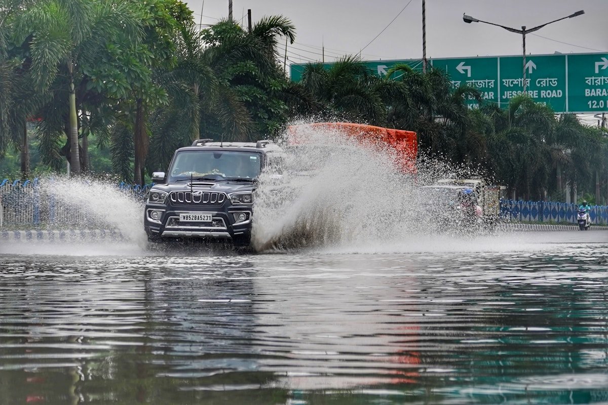
Infrastructure and flooding. The same system delivering deficits to some regions has brought deadly floods to others. At least 25 people have died across northern India in flash floods and landslides triggered by intense monsoon downpours. Roads have washed out and bridges have collapsed, leaving entire villages cut off for days at a time. In Southeast Asia, torrential monsoon rains have triggered landslides across multiple countries, displacing thousands of people from their homes. The contrast is stark: one region prays for rain while another evacuates from it.
Economy. Monsoon performance directly affects India’s GDP. A strong monsoon boosts rural demand. Tractors sell more. Fertilizer orders rise. Two-wheeler showrooms see foot traffic when farmers expect a good harvest. A below-normal season shrinks that spending across the board. Food prices also respond. Staple crops see price spikes when supply tightens. In 2026, the combination of below-normal rain and higher temperatures has already pushed up power demand for cooling. That puts strain on India’s electricity grid during the hottest months.
Water resources. Reservoir levels in several Indian states entered the monsoon season below their 10-year averages. A subpar July will make replenishment difficult. Cities that rely on reservoir-fed water systems, from Chennai to Hyderabad, watch the monsoon numbers with genuine concern. Urban water rationing becomes a real possibility when July rains fall short.
What’s Driving This Season: The Climate Puzzle
The monsoon is one of the most complex climate systems on Earth. It is not a single storm that arrives on schedule. It is a seasonal wind shift that draws moisture from the Indian Ocean and Arabian Sea across the subcontinent. That simple description, the seasonal reversal of wind direction bringing ocean moisture over land, hides an engine with many moving parts.
The 2025-2026 El Niño event transitioned to neutral conditions in early 2026. El Niño typically suppresses the Indian monsoon by shifting warm water and convection eastward into the Pacific. The neutral phase should be better news. The monsoon does not respond to any single driver alone. Ocean temperatures in the Indian Ocean exert their own influence. Snow cover over the Eurasian landmass changes the thermal gradient that pulls the monsoon north. Intraseasonal oscillations create active and break periods within the season. The patchy 2026 season reflects these multiple competing influences, each pulling in a different direction.
Warmer air also holds more moisture. When it does rain, it rains harder. The intense downpours now hitting Chhattisgarh and Odisha fit this pattern. Climate change does not create the monsoon, but it supercharges it, producing fewer rainy days overall while delivering far more extreme rainfall when those days arrive. The IMD has documented this trend across multiple recent monsoon seasons.
For Southeast Asia, the drivers differ. The ASMC outlook points to warmer sea surface temperatures in the eastern Indian Ocean and the waters around the Maritime Continent. These warm waters feed additional moisture into monsoon flows affecting Myanmar and Thailand. The Mekong region receives the same boost. The result is the above-normal rainfall that forecasters are watching closely.
For a deeper explanation of the monsoon mechanism, How Monsoons Work walks through the seasonal wind shift that drives this entire system.
What to Expect Next: August Through September
The monsoon season 2026 still has two critical months ahead. August and September account for roughly 60 percent of India’s total monsoon rainfall. A weak July does not guarantee a failed season. The 2019 monsoon saw a delayed start and a 33 percent June deficit. It finished at 110 percent of the LPA after a strong August and September pushed totals well above normal.
The IMD’s updated forecast for the second half of the season will be released in early August. That update will determine whether the 94-percent LPA projection holds or worsens. For now, the low-pressure activity over the Bay of Bengal suggests the monsoon remains active. Additional systems in late July could narrow the rainfall gap further. If they form, farmers in deficit regions will get their planting window back.
For Southeast Asia, the outlook is more consistent. The ASMC seasonal outlook maintains above-normal rainfall through September for coastal Myanmar. The TMD’s short-range forecast through July 25 points to an active trough over Thailand. Communities in flood-prone areas should remain alert through at least mid-September.
The WMO ASEAN Climate Outlook provides the broadest view. The consensus among national meteorological agencies is clear: a wetter-than-normal second half of the season for much of mainland Southeast Asia.
If you live in a monsoon-affected region, the practical steps are straightforward. Check your local meteorological agency’s short-range forecast before making travel or planting decisions. If you are in a flood-prone zone, know your evacuation route now, not when the water is rising. The 2026 season is not a failure. It is a reminder that the monsoon has always been about distribution. Total rainfall numbers can mislead. A few hundred kilometers can separate flood from drought.