
On July 6, 2026, the eyewall of Super Typhoon Bavi passed directly over the island of Rota in the Northern Mariana Islands with sustained winds of 180 mph. It was the strongest storm to strike the US Pacific territory in nearly four years, and it was only getting started. Over the next eight days, Bavi would carve a 3,000-mile path of destruction across five countries and territories, trigger the evacuation of nearly 2 million people in China, and become one of the most geographically sprawling typhoons of the decade.
What Happened: The Track of Super Typhoon Bavi
Super Typhoon Bavi formed in the warm waters of the western Pacific in early July 2026. The storm underwent rapid intensification starting July 4, feeding on sea surface temperatures of 30°C (86°F), and reached Category 5 equivalent status with maximum sustained winds of 290 km/h (180 mph) according to the Joint Typhoon Warning Center (JTWC). It was the third Category 5 equivalent storm on Earth in 2026, following Tropical Cyclone Horacio in February and Super Typhoon Sinlaku in April.
On July 6, the storm hammered the US territories of Guam and the Northern Mariana Islands. The eye passed directly over Rota, an island 40 miles northeast of Guam with roughly 2,500 residents. Authorities on Rota reported “major damage” with winds that toppled concrete power poles, stripped roofs, and left the island’s port inoperable. Thousands across Guam and the Northern Marianas lost power. Remarkably, no casualties were reported on the islands, a testament to the region’s typhoon-hardened building codes and early warning systems.
The storm then tracked west-northwest. On July 10, heavy rains from Bavi’s outer bands triggered landslides in the Philippines that killed at least 15 people, with the death toll later revised to 18 according to Philippine disaster authorities. Taiwan reported 36 injuries as the storm grazed the island’s eastern coast.
On July 12, Bavi made landfall on China’s Zhejiang coast as a weakening but still powerful typhoon. Chinese authorities mounted what became the largest weather evacuation of 2026: 1.72 million residents were moved inland, and 17,000 rescue workers were deployed ahead of the storm according to state media reports. Two days later, as the storm’s remnants moved into northeastern Liaoning province, another 260,000 people were evacuated amid intense flooding, making the combined evacuation total nearly 2 million people.
At its peak size, Bavi’s cloud field stretched roughly 1,000 kilometers across, about the width of France according to The New York Times. The storm finally dissipated over Manchuria on July 14.
Why It Happened: The Science Behind Bavi’s Power
Three ingredients turned Bavi from a tropical depression into one of 2026’s most powerful storms. The simplest explanation: a typhoon is a heat engine, and Bavi had exceptional fuel.
Warm ocean water. Sea surface temperatures across the western Pacific were about 30°C (86°F) during Bavi’s intensification phase. Tropical cyclones need water at least 26.5°C (80°F) to strengthen. Bavi was crossing water 3 to 4 degrees above that threshold. The scientific term for this is ocean heat content, which measures not just the surface temperature but how deep the warm water layer extends. Deeper warm water means the storm churns up less cold water from below, allowing uninterrupted intensification.
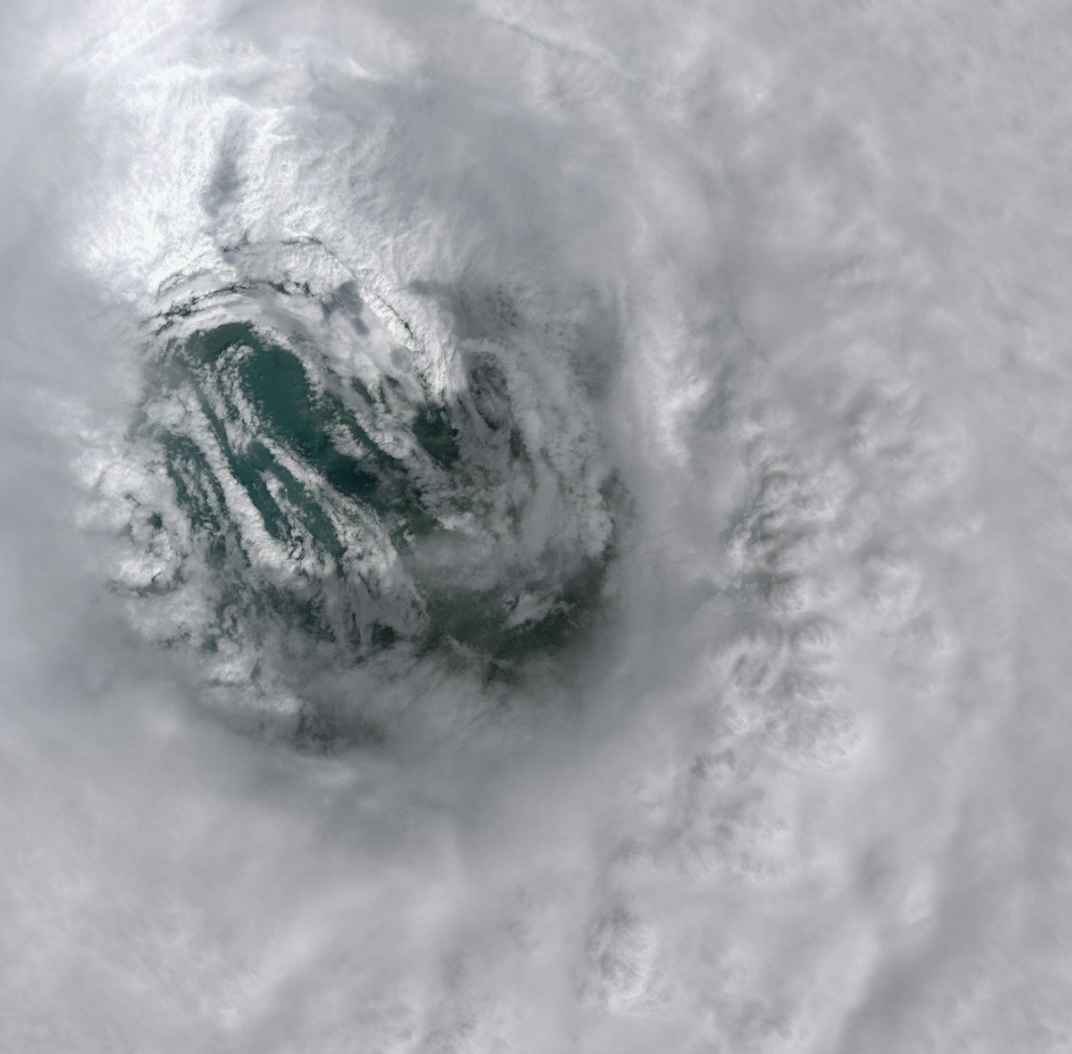
Low wind shear. Wind shear, the change in wind speed and direction with height, tears the top off a developing cyclone. Throughout Bavi’s early track, shear was below 10 knots, allowing the storm’s towering thunderstorms to build vertically without being torn apart. The NASA Scientific Visualization Studio confirmed that satellite imagery showed a textbook symmetric structure with a well-defined eye, a signature of low-shear environments.
Rapid intensification. Bavi’s winds increased by roughly 60 mph in 24 hours between July 3 and July 4, meeting the meteorological definition of rapid intensification. This happens when all the ingredients align perfectly: warm water, low shear, and moist mid-level air. The JTWC noted that Bavi underwent an eyewall replacement cycle shortly before hitting Rota, a phenomenon where a new eyewall forms around the old one, temporarily broadening the storm’s wind field. This is why Rota, directly in the path, experienced the storm’s most violent winds.
For readers looking to understand the mechanics behind cyclones like Bavi, our guide to how hurricanes form explains the full lifecycle from tropical wave to monster storm.
How It Affected People: Five Countries, One Storm
A typhoon’s damage is not measured in wind speed alone. Different communities experienced Bavi in completely different ways, and the contrast reveals a lot about how wealth, infrastructure, and geography shape disaster outcomes.
Guam and the Northern Marianas: damage without death. On Rota, where the eyewall passed directly overhead, winds of 290 km/h destroyed homes, stripped vegetation bare, and knocked out the island’s power grid and port. On nearby Guam, thousands lost electricity. But the death toll was zero. This outcome traces directly to building codes hardened after successive typhoons, including Super Typhoon Yutu in 2018 and Super Typhoon Sinlaku in April 2026. Concrete construction, mandatory storm shutters, and a population that takes typhoon warnings seriously saved lives, even when buildings could not be saved.
The Philippines: rain, not wind, was the killer. Bavi never made direct landfall in the Philippines, but its outer rain bands dumped more than 300 mm (12 inches) of rain on already-saturated mountain slopes. At least 18 people died in landslides across northern Luzon, according to the Philippine disaster agency. This is a tragically familiar pattern: in the Philippines, where steep terrain meets informal hillside housing, the deadliest part of a typhoon is often the rain, not the wind.
China: the largest weather evacuation of 2026. Chinese authorities have refined mass evacuation into a practiced science. Before Bavi’s Zhejiang landfall, 1.72 million people were moved to shelters and higher ground. Fishing fleets were recalled to port. The government deployed 17,000 rescue personnel. Two days later in Liaoning province, another 260,000 were evacuated as river flooding spread. The scale is staggering: nearly 2 million people displaced, yet the death toll in China was contained to single digits. For comparison, Typhoon Lekima in 2019 killed 56 in the same region with far fewer evacuations.
Taiwan: glancing blow, real injuries. Bavi’s track passed east of Taiwan, but the storm’s vast size meant the island still caught typhoon-force winds along its eastern coast. The Central Weather Bureau reported 36 injuries, mostly from falling debris and traffic accidents during heavy rain. Schools and offices closed for a day. The island’s robust early warning system and mountain evacuation protocols, refined through decades of typhoon experience, prevented worse outcomes.
Why It Matters Now: The New Normal for Pacific Typhoons
Bavi was extreme, but it was not an anomaly. It was the second super typhoon to strike the Northern Marianas this year; Sinlaku hit the same islands in April 2026. The 2026 Pacific typhoon season is running ahead of the 30-year average for accumulated cyclone energy, a measure of total storm power.
The science points to warming oceans as the amplification mechanism. The western Pacific warm pool, the region where most super typhoons are born, has warmed by roughly 0.3°C per decade since the 1980s according to NOAA Climate.gov. A warmer ocean does not necessarily produce more typhoons, but it does make the ones that form more likely to become major storms. Research published in the Proceedings of the National Academy of Sciences found that the proportion of tropical cyclones reaching Category 4 or 5 intensity has increased globally by about 25% per decade since 1979.
There is also a specific human vulnerability at play. The evacuation of 2 million people in China is an operational success, but it also illustrates the scale of the population now living in typhoon-prone coastal zones. China’s eastern seaboard is home to hundreds of millions of people. Every major landfall now triggers a migration event the size of a major city. The cost of these evacuations, in economic disruption, emergency spending, and lost productivity, is rising even as the death toll falls.
Bavi also reinforces a lesson the Northern Marianas learned the hard way: places that get hit once are likely to get hit again. Rota and Guam have now faced two super typhoons in three months. Recovery from Sinlaku was still underway when Bavi arrived. For small island communities, the compounding effect of back-to-back disasters stretches emergency budgets, insurance pools, and the psychological resilience of residents to the breaking point.
What We Can Learn: Preparedness Saves Lives, but Recovery Is the Real Test
The story of Bavi contains both a triumph and a warning. The triumph is that a Category 5 storm can pass directly over an inhabited island and kill no one. The Northern Marianas proved that strong building codes, early warnings, and community preparedness work. The warning is that the same storm killed 18 people in the Philippines not through wind but through rain, and that the sheer geographic scale of modern typhoons now forces governments to evacuate cities the size of Houston on a few days’ notice.
If you live on a coast anywhere in the western Pacific, from the Philippines to Japan to China, there are practical steps to take before the next storm forms. Know your evacuation zone. Keep a go-bag with three days of water, food, medicine, and a battery-powered radio. Sign up for local emergency alerts. And understand that the most dangerous part of any tropical cyclone is often not the wind, but the water. Both from storm surge at the coast and from freshwater flooding and landslides inland. For a deeper dive into storm preparedness, our guide to hurricane safety covers the essentials that apply equally to typhoons. And for the bigger picture on what is driving stronger storms, our climate change explainer breaks down the connection between warming oceans and extreme weather.
For the people of Rota and Guam, the test now is not whether they can survive the next storm. They have proven they can. The test is whether the resources for recovery: federal aid, insurance payouts, rebuilt infrastructure. Can they arrive faster than the next super typhoon.
Super Typhoon Bavi 2026: Key Facts
- Peak intensity: 290 km/h (180 mph) sustained winds, Category 5 equivalent
- Minimum pressure: ~915 hPa
- Lifespan: July 1–14, 2026 (14 days)
- Landfall locations: Rota (Northern Marianas), Zhejiang (China)
- Countries/territories affected: Guam, Northern Mariana Islands, Philippines, Taiwan, China
- Casualties: 18 dead (all in the Philippines from landslides); 0 in Guam/NMI; 36 injured in Taiwan
- Evacuations: ~2 million people in China (1.72M in Zhejiang + 260K in Liaoning)
- Storm size: Approximately 1,000 km across at peak, roughly the width of France
- Notable: Third Category 5 equivalent storm globally in 2026; second super typhoon to hit the Northern Marianas in 3 months
Sources: Joint Typhoon Warning Center, NASA Scientific Visualization Studio, The Watchers, The New York Times, Al Jazeera, Eastern Herald