El Niño 2026 Has Officially Begun: What It Means for Global Weather
What Exactly Is El Niño?
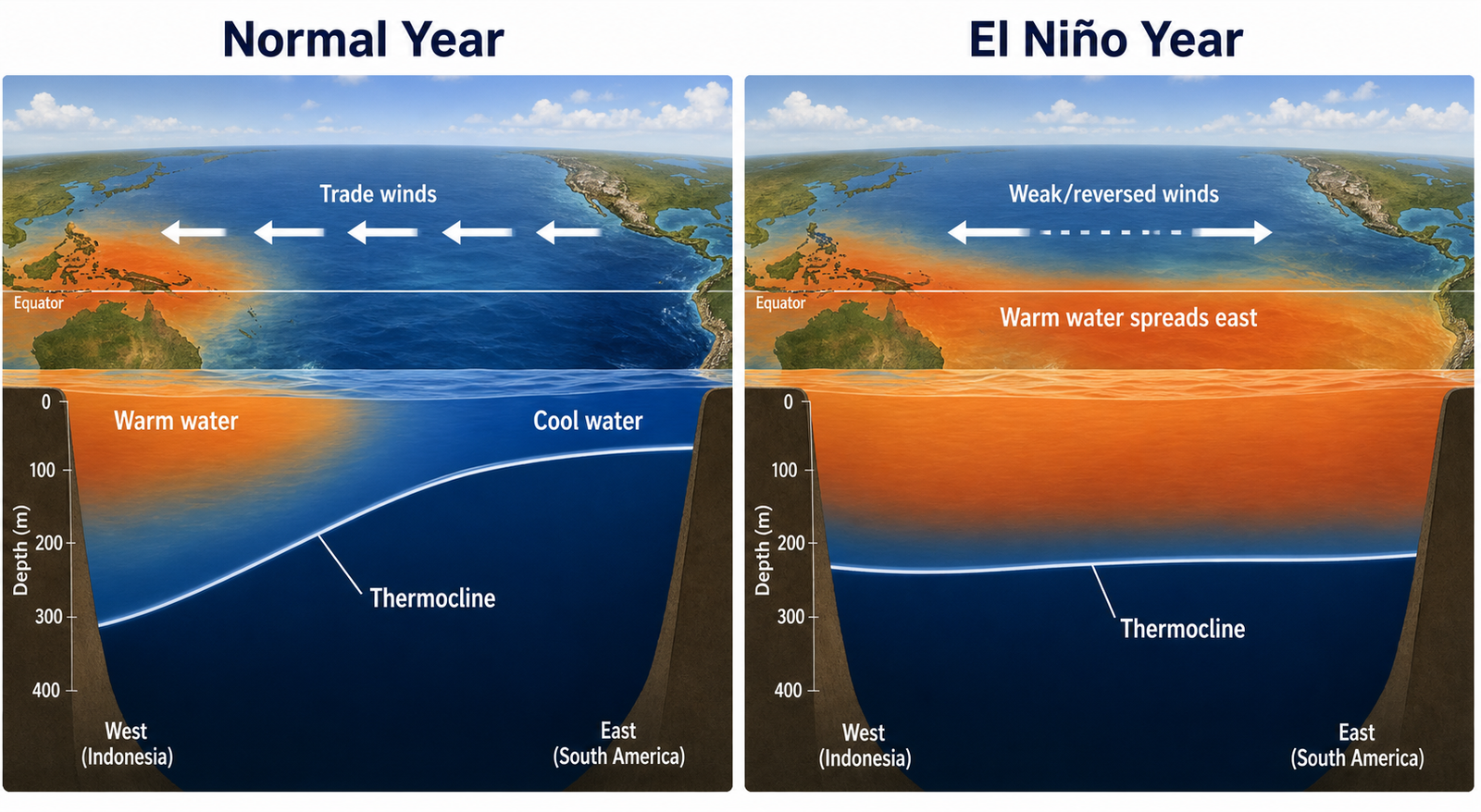
El Niño is the warm phase of the El Niño-Southern Oscillation (ENSO), a natural climate cycle centered on the tropical Pacific Ocean. Under normal conditions, trade winds push warm surface water westward toward Indonesia, allowing cooler water to well up near South America.
During El Niño, those trade winds weaken or reverse. Warm water sloshes back eastward, spreading across the central and eastern Pacific. That pool of abnormally warm water pumps heat and moisture into the atmosphere, disrupting global circulation patterns.
The result is a cascade of weather effects: some regions get drenched, others go bone-dry, and global average temperatures climb.
How Strong Could This One Get?
Early forecasts from NOAA’s Climate Prediction Center suggest a moderate to strong event is likely, with a greater than 60 percent chance of a strong El Niño by the peak season in late 2026. Ocean temperature anomalies in the key monitoring region known as Niño 3.4 have already reached 1.1 degrees Celsius above average and are still climbing.
The WMO notes the past eleven years have been the warmest on record. An El Niño layered on top of that long-term warming trend could push 2026 or 2027 to become the hottest year ever measured.
That heat will not be evenly distributed. Some regions will feel it far more than others.
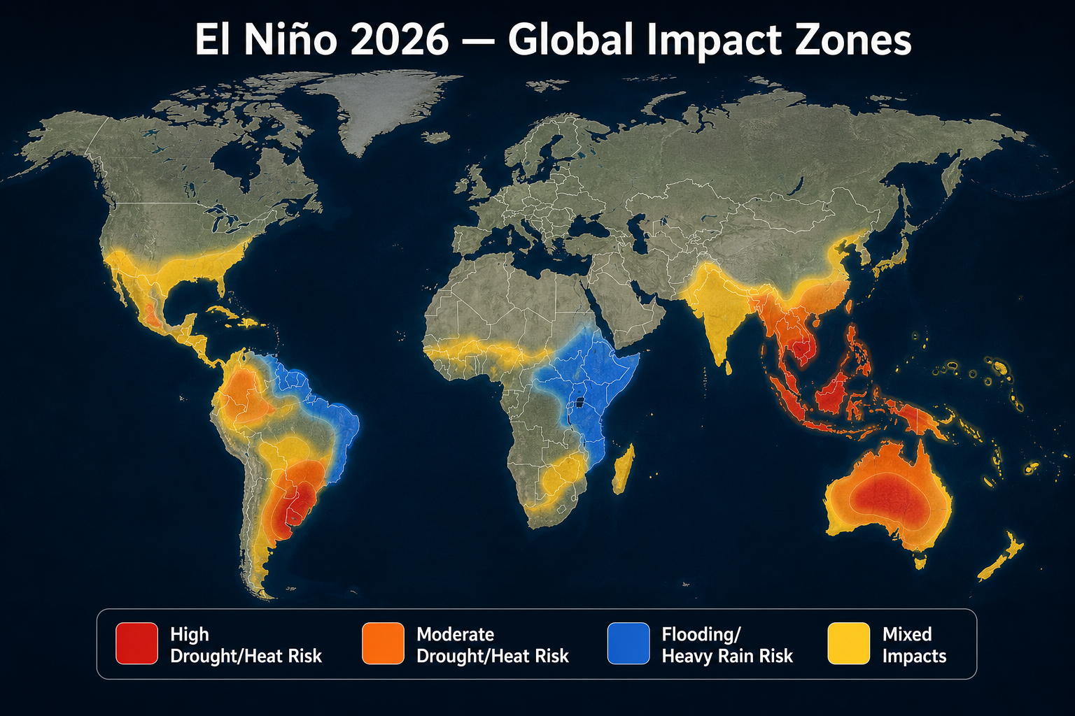
Which Regions Should Prepare
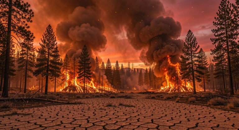
Southeast Asia and Australia face elevated drought and wildfire risk. During El Niño, rainfall shifts away from the western Pacific, leaving Indonesia, the Philippines, and eastern Australia drier than normal. Australia’s Bureau of Meteorology has already raised its fire danger outlook for the coming summer.
East Africa could see heavy rainfall and flooding. El Niño often enhances the short rains season from October to December, turning parched landscapes into flood zones. The 1997-1998 El Niño caused devastating floods across Kenya and Somalia.
South Asia faces a tricky balance. El Niño is historically linked to weaker Indian monsoon seasons, which could threaten crop yields for hundreds of millions of farmers. Coming after a punishing pre-monsoon heat season, that would compound food and water stress.
North America typically sees a split: wetter and cooler across the southern United States and northern Mexico, drier and warmer across the Pacific Northwest and Canada. California could see a repeat of the 2015-2016 winter when El Niño-fueled storms eased drought but also triggered mudslides.
South America experiences some of the most direct impacts. Peru and Ecuador face heavy rainfall and flooding along their coasts while the Amazon basin becomes drier, raising fire risk in the rainforest.
What About the Atlantic Hurricane Season?
Here is a rare piece of relatively good news. NOAA is forecasting a 55 percent chance of a below-normal Atlantic hurricane season in 2026. El Niño tends to increase wind shear over the tropical Atlantic, which tears apart developing storms before they can organize.
However, this is not a guarantee. The 2018 season was also forecast to be below normal, and it produced Hurricane Michael, a Category 5 storm that devastated the Florida Panhandle. El Niño reduces the odds of storm formation but does not eliminate the risk.
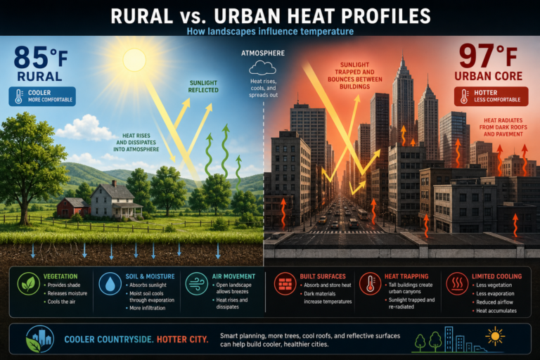
The Heat Factor
One of the most reliable effects of El Niño is a spike in global average temperatures. The massive pool of warm Pacific water acts like a planetary heater, releasing stored ocean heat into the atmosphere over many months.
For communities already dealing with summer heat, this means preparing for longer and more intense heatwaves. The World Weather Attribution group has already flagged the 2026 FIFA World Cup, now underway across North America, as a major event where extreme heat could affect athletes and fans.
City governments from Phoenix to Paris are updating their heat action plans. Cooling centers, extended public pool hours, and check-in programs for elderly residents are becoming standard responses.
Practical Ways to Prepare
If you live in a region likely to face El Niño impacts, a few practical steps can help. For drought-prone areas, water conservation now pays off later; fixing leaks, mulching gardens, and storing emergency water are smart moves. For flood-risk zones, checking drainage systems and having an evacuation plan matters.
For heatwaves, the basics remain the most effective: stay hydrated, limit outdoor activity during peak afternoon hours, and never leave children or pets in parked vehicles.
The WMO emphasizes that early warning saves lives. This El Niño is not a surprise. Scientists have been tracking its development for months, and governments have had time to prepare.
What happens next depends on both the strength of the event and how seriously communities take the warnings.
Sources: World Meteorological Organization (WMO) El Niño update, June 2026 · NOAA Climate Prediction Center ENSO diagnostic discussion · BBC News · Reuters · World Weather Attribution 2026 analysis