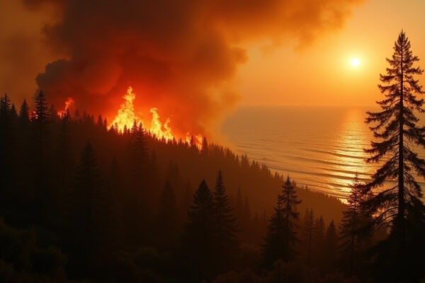
On June 29, 2026, a fire ignited in southern Colorado near a leaning tree on a power line. By the third week of July, it had become the eighth largest wildfire in state history. It has now burned 100,244 acres, destroyed 851 structures, and forced thousands from their homes across Custer and Pueblo counties.
What the Aspen Acres Fire Has Destroyed
The fire started 20 miles from Pueblo and spread rapidly through dry timber and grassland. As of July 18, 2026, it had consumed over 100,000 acres. That is roughly twice the size of the city of Denver. Containment has reached 61 percent after nearly three weeks of round-the-clock firefighting.
The structural toll is staggering. Officials confirmed 851 structures destroyed. That includes 337 homes in Pueblo County and 83 homes in Custer County. The remaining losses include outbuildings, barns, vehicles, and other property damaged beyond repair. This makes it the most destructive Colorado wildfire since the Marshall Fire in December 2021, which incinerated more than 1,000 homes in Boulder County.
More than 1,500 firefighters and support personnel are assigned to the blaze. They include hotshot crews working the steepest terrain, engine companies protecting structures, helicopter pilots dropping water on flare-ups, and air tanker crews laying retardant lines. The National Interagency Fire Center raised the national preparedness level to 4 out of 5 by late June, signaling that firefighting resources across the country are stretched thin. Some 68 large fires are currently burning across 15 states.
How It Started and Why It Grew So Fast
Investigators with the Colorado Division of Fire Prevention and Control confirmed the fire was caused by human activity. Exactly how remains under investigation. A witness reported seeing a large tree leaning on a power line on the morning of June 29 in the area where the fire started, according to court filings. A lawsuit filed against San Isabel Electric Association alleges the utility is responsible.
But the question of ignition is only part of the story. The fire grew explosively because it landed on a landscape primed to burn. Colorado is in the grip of a long-running drought that has left forests and grasslands brittle. The U.S. Drought Monitor shows much of southern Colorado in severe to extreme drought. Hot, dry winds pushed flames through canyons and over ridges faster than ground crews could keep up. In its first week the fire doubled in size multiple times.
This is the pattern scientists have documented across the American West. Warmer temperatures pull moisture out of vegetation, creating what firefighters call “receptive fuel beds.” When ignition arrives, whether from a power line, a lightning strike, or a campfire, the fire has everything it needs to run. The Aspen Acres Fire followed that script precisely.
How the Fire Has Affected People
The human impact reaches well beyond the evacuation zones. Mandatory evacuation orders emptied communities in both Pueblo and Custer counties, with thousands of residents displaced for weeks. By mid-July, many evacuation orders had been downgraded to pre-evacuation status as containment grew. Families returned to find entire neighborhoods reduced to ash.
Health effects have rippled outward. Smoke from the Aspen Acres Fire combined with smoke from fires burning across Canada, the Pacific Northwest, and other Western states. By July 17, a thick haze covered the eastern U.S. from the Great Lakes to Washington, D.C. Air quality alerts stretched from Minnesota to New England. This is the same smoke pattern that NWH has been tracking from Canada’s 850+ wildfires all summer. For people with asthma, heart conditions, and respiratory illnesses, this smoke is more than an inconvenience. It is a genuine health risk.
The economic damage is still being tallied. The 851 destroyed structures represent hundreds of millions of dollars in lost property. Insurance claims will take years to process. For homeowners who were underinsured or whose policies excluded wildfire damage, the financial burden is permanent. Local businesses in evacuated areas lost critical summer revenue. Farmers and ranchers saw grazing land burn.
Firefighters on the line face risks that go beyond the flames themselves. Three firefighters have died fighting Colorado wildfires this season. Heat exhaustion, falling trees, and unpredictable fire behavior make every shift dangerous. As one operations chief told a briefing, “We anticipate this fire being here, present on the mountains in that steep country for quite a while.”
Why the Aspen Acres Fire Matters Beyond Colorado
This fire is not an isolated disaster. It is part of a 2026 wildfire season that is running well above the 10-year average. As of mid-July, 37,783 wildfires had burned more than 3.4 million acres across the United States, according to the National Interagency Fire Center. That represents 130 percent of the 10-year average for number of fires and 146 percent for acres burned. Utah alone has seen over 239,000 acres go up in flames. Meanwhile, lightning-sparked fires in the Pacific Northwest have added more than 100,000 acres to the national tally.
The same climate forces driving the Aspen Acres Fire are shaping events across the country. A stubborn heat dome parked over the Western U.S. has produced record temperatures and dried out vegetation on a continental scale. In Texas, the same atmospheric pattern delivered catastrophic flooding that killed at least two people and triggered hundreds of water rescues in the Hill Country. Wildfire smoke, flash floods, and heat waves are different expressions of the same destabilized climate system.
The fire season is not over. August and September are traditionally the peak months for large wildfires in the West. With the national preparedness level already at 4, firefighting agencies are bracing for what could be an exhausting second half of the season. The resources needed to fight one massive fire like Aspen Acres make it harder to respond quickly to new ignitions elsewhere.
What People Can Learn From This Fire
The Aspen Acres Fire reinforces several practical lessons. The first is about preparedness. Every household in wildfire-prone areas needs a go-bag, an evacuation plan, and a clear understanding of their insurance coverage. The difference between families who evacuated safely and those who barely escaped often came down to whether they had already packed their documents, their medications, irreplaceable photos, and other essential items.
The second lesson concerns infrastructure. If the lawsuit’s allegations about a power line are substantiated, this fire will join a long list of catastrophic wildfires started by electrical equipment. California’s Camp Fire in 2018, the Marshall Fire in 2021, and now potentially the Aspen Acres Fire all trace back to the same vulnerability. Upgrading utility infrastructure and burying power lines in high-risk corridors is expensive, but it is cheaper than rebuilding entire communities.
The third lesson is about air quality awareness. Wildfire smoke travels hundreds or even thousands of miles. People far from the flames need to pay attention to air quality index readings, keep N95 masks on hand, and run indoor air purifiers during smoke events. What happens in a Colorado canyon does not stay there. It finds its way into the air you breathe, even if you live a thousand miles away.
The Colorado Division of Fire Prevention and Control continues its investigation into the cause of the Aspen Acres Fire. Full containment may still be weeks away. But the lessons this fire teaches about preparedness, infrastructure resilience, and living with climate risk are available right now.
- Fire start: June 29, 2026
- Location: Custer and Pueblo counties, southern Colorado
- Acres burned: 100,244 acres (as of July 18)
- Containment: 61 percent
- Structures destroyed: 851 (including 337 homes in Pueblo County and 83 homes in Custer County)
- Personnel: 1,500+ firefighters and support
- Cause: Human-caused, under investigation
- National preparedness level: 4 out of 5
- U.S. acres burned in 2026: 3.4 million (146% of 10-year average)