Why Illinois Now Leads the Nation in Tornadoes — and What’s Driving the 2026 Surge
You don’t expect Illinois to lead the nation in tornadoes. But here we are.
On June 11, 2026, a severe weather outbreak tore across northern Illinois and northwest Indiana. The National Weather Service in Chicago has confirmed at least 7 tornadoes so far, including two EF-3s — one near Streator, Illinois, and another near Kouts, Indiana. That brings Illinois’ 2026 tornado count to 140.
That’s the most of any state in the country. And according to CBS Chicago, it’s the third time in the last four years Illinois has held that unwanted title.
So what’s going on? Is the Midwest becoming the new Tornado Alley? And what does a developing El Niño have to do with it?
Let’s break it down.
What happened on June 11
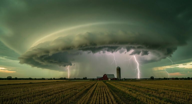
The storms fired up Thursday afternoon and kept going into the night. Supercells dropped tornadoes across a broad swath from north-central Illinois into northwest Indiana.
The strongest was the EF-3 near Streator, about 90 miles southwest of Chicago. It carved a path through rural farmland and damaged multiple homes. Another EF-3 hit near Kouts, Indiana, about 50 miles southeast of Chicago.
But the outbreak wasn’t just about the big ones. NWS Chicago’s preliminary event page (weather.gov/lot/2026_06_11_SevereWeather) lists multiple weaker tornadoes too — spin-ups that touched down briefly in open fields and suburban areas.
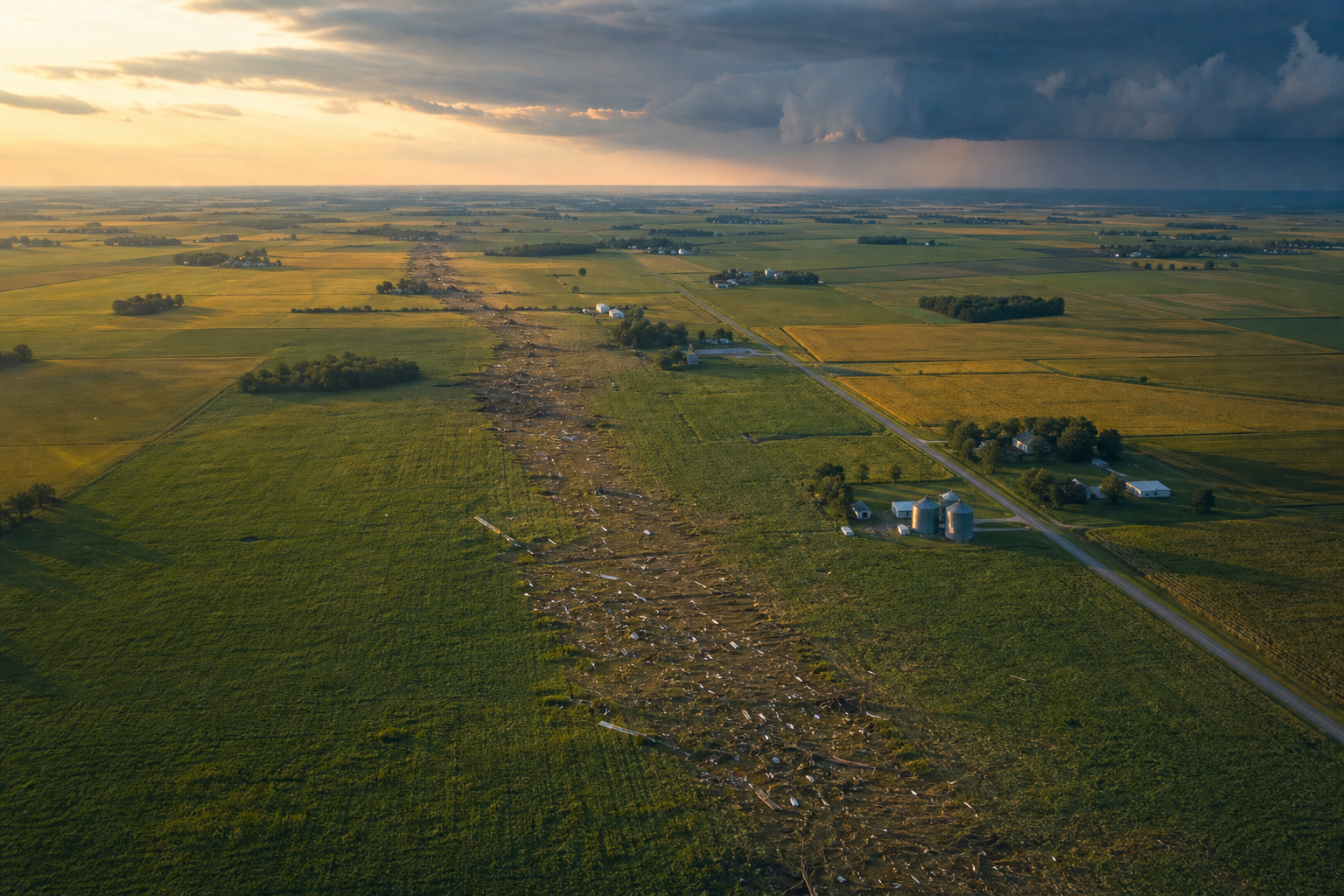
The same storm system also dumped heavy rain. Some spots got up to 3.16 inches, causing localized flooding alongside the tornado damage.
In the Naperville-Woodridge-Willow Springs corridor, CNN reports that more than 230 homes were damaged. Multiple people were killed — though the exact number is still being confirmed as search and rescue teams work through the debris.
140 tornadoes and counting
Let’s put that number in perspective.
Illinois has already recorded 140 tornadoes in 2026 — and we’re only halfway through the year. The typical annual average for the state is around 50 to 60.
That’s not a fluke. It’s a pattern.
Illinois has led the nation in tornado counts for three of the last four years. The traditional Tornado Alley — Kansas, Oklahoma, Texas — has actually seen relatively quiet seasons by comparison. Instead, the action has shifted east and north.
Meteorologists call this “Tornado Alley migration,” and it’s been happening for years.
Why is Illinois getting hammered?
There’s no single answer, but several factors are converging.
First, the jet stream pattern. A persistent trough in the western US and a ridge in the east has been steering storm systems right through the Midwest. When you combine that with warm, moist air from the Gulf of Mexico (which has been running above average this spring), you get the instability needed for powerful thunderstorms.
Second, the developing El Niño. NOAA’s Climate Prediction Center confirmed El Niño conditions are present as of June 11, 2026 — and models suggest it could strengthen into a “super El Niño” by winter. Here’s the counterintuitive part: El Niño doesn’t always suppress severe weather in spring. In fact, certain El Niño patterns can enhance tornado activity in the Midwest by shifting the jet stream and increasing wind shear.
We have a full explainer on what El Niño means for 2026 if you want the deeper dive.
Third, climate variability. This is where the weather vs climate distinction matters. No single tornado or even a single season can be blamed on climate change. But the broader trends — warmer Gulf waters, more atmospheric moisture, shifting storm tracks — are consistent with what climate models have been projecting for decades.
As our earlier coverage of the 2026 tornado outbreak notes, this year’s activity fits a pattern meteorologists have been tracking since the early 2010s.
The Streator tornado up close
The Streator EF-3 deserves special attention. It was what storm chasers call a “wedge tornado” — wide, rain-wrapped, and hard to see until it’s right on top of you.
The supercell that produced it formed along a dryline in central Illinois, then tracked northeast. NWS damage surveys found evidence of winds around 150 mph near the core of the damage path.
What made this storm particularly dangerous was its speed. It moved at around 45 mph, which means residents had very little warning time — maybe 10 to 15 minutes from the initial tornado warning to impact.
That’s why the NWS has been pushing its “warn on forecast” technology, which aims to give people 30 to 60 minutes of lead time instead. The system isn’t fully operational yet, but it’s being tested in regions like this.
What you need to know going forward
Tornado season isn’t over. June and July can still produce significant outbreaks, especially when a developing El Niño keeps the atmosphere energized.
If you live in Illinois or the broader Midwest, here’s the bottom line:
- Have multiple ways to get warnings. Phone alerts, NOAA weather radio, and a weather app with push notifications.
- Know your safe place. Basement, interior room, or a tornado shelter.
- Don’t wait until you see the tornado. By the time you spot it, it may be too late.
The 2026 season is already historic. And with climate patterns shifting, Illinois might stay in the crosshairs for years to come.
Sources: NWS Chicago, CBS Chicago, CNN, NOAA/CPC