How Clouds Form and What They Tell You About Tomorrow’s Weather
How Clouds Form and What They Tell You About Tomorrow’s Weather
Look up. The clouds above you right now are not random — they are telling you something. Every cloud has a story. It tells you what the air is doing, how much moisture is up there, and — if you know what to look for — what the weather will do next.
No weather app required.
How Clouds Form in 60 Seconds
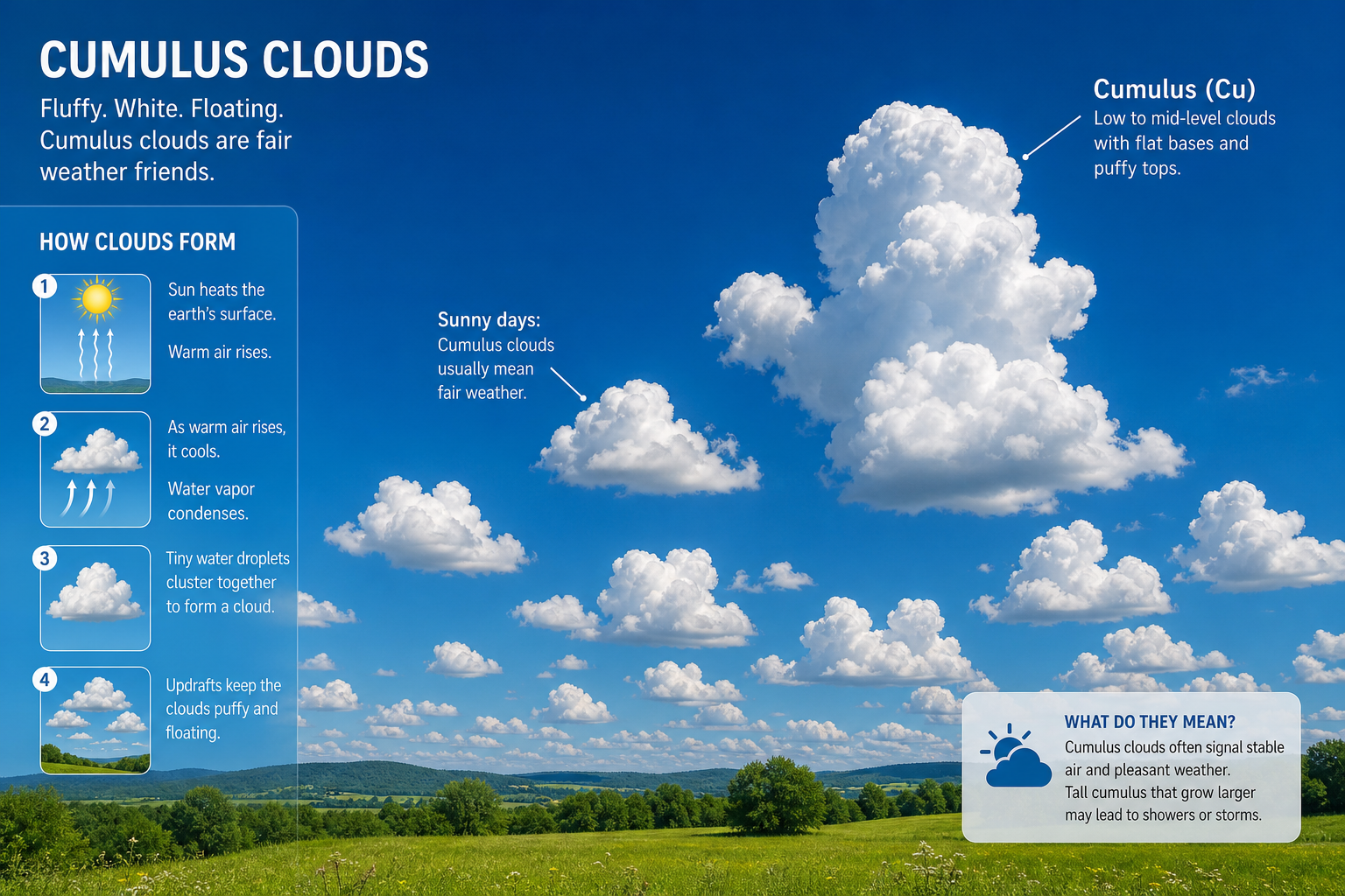
Clouds are just water. Tiny droplets or ice crystals suspended in the air. They form through one simple process:
- Warm, moist air rises. This happens when the sun heats the ground, or when warm air meets cold air along a front.
- As the air rises, it cools. Cool air holds less water vapor than warm air.
- The water vapor condenses. It turns back into liquid droplets, attaching to microscopic particles — dust, salt, smoke — floating in the air.
- Billions of these droplets together form a visible cloud.
That is it. The type of cloud that forms depends on how fast the air rises, how much moisture is present, and how stable the atmosphere is.
The 10 Main Cloud Types
Clouds are classified by their shape and altitude. The World Meteorological Organization recognizes 10 main types. Here are the ones that matter most for predicting weather:
High Clouds (Above 6,000 meters / 20,000 feet)
- Cirrus: Thin, wispy, feather-like. Made of ice crystals. What they mean: Fair weather for now, but if they thicken, a warm front might be approaching in the next 24-36 hours.
Mid-Level Clouds (2,000-6,000 meters / 6,500-20,000 feet)
- Altocumulus: Patches or layers of small, puffy clouds — sometimes called a “mackerel sky.” What they mean: If you see these on a warm, humid morning, thunderstorms may develop by afternoon.
- Altostratus: Gray or bluish sheets covering the sky. The sun appears dim, like behind frosted glass. What they mean: Steady rain or snow is likely within hours.
Low Clouds (Below 2,000 meters / 6,500 feet)
- Cumulus: The classic puffy, cotton-ball cloud. Flat bottom, rounded top. What they mean: Fair weather if they stay small. If they grow tall and dark at the base — they are becoming cumulonimbus, and a storm is coming.
- Stratus: A uniform gray layer, often covering the whole sky like a blanket. What they mean: Drizzle or light rain possible. Not heavy — just persistent grayness.
- Nimbostratus: Thick, dark, rain-producing layer. What they mean: Steady, prolonged rain or snow. This is the cloud that ruins your outdoor plans for the whole day.
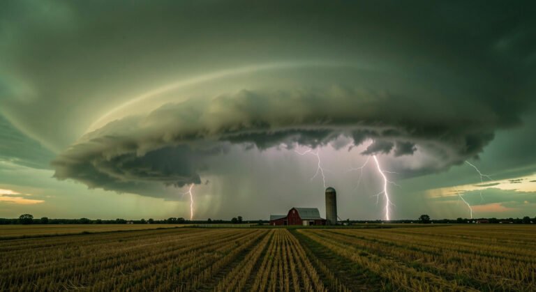
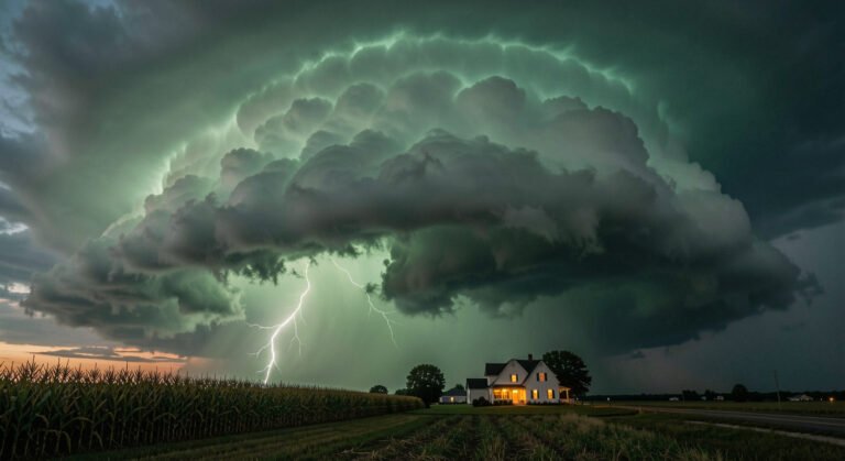
Vertical Clouds (Towering Through All Levels)
- Cumulonimbus: The thunderstorm cloud. It can stretch from near the ground to over 12,000 meters (40,000 feet). Flat, anvil-shaped top. Dark base. What they mean: Heavy rain, lightning, hail, possibly tornadoes. Take cover.
Cloud Spotting: Read the Sky
Here are three practical weather predictions you can make just by looking up:
1. “Fair weather for the next few hours.”
Small, scattered cumulus clouds with blue sky in between. No dark bases. No vertical growth.
2. “Rain is coming — probably today.”
Clouds are thickening and lowering. Cirrus gives way to altostratus, which gives way to nimbostratus. The sky turns milky, then gray, then dark.
3. “A thunderstorm could develop.”
Cumulus clouds are growing upward — becoming taller than they are wide. The base is getting dark. The top looks like a cauliflower. If the top flattens into an anvil shape, the storm is mature.
A Skill That Costs Nothing
You do not need a meteorology degree to read clouds. Just attention. Look up more often. Notice what is there. Compare it to what happens next. In a few weeks, you will start to see patterns that weather apps can only approximate.
The sky is the original forecast — and it is always live.
Written by NatureWeatherHub — your simple guide to weather, nature, and the planet.