2026 Atlantic Hurricane Season Forecast: Below-Normal Activity Expected
What Forecasters Are Saying About the 2026 Season
On May 21, 2026, NOAA released its official Atlantic hurricane season outlook from the agency’s Aircraft Operations Center in Lakeland, Florida. The numbers tell a story most coastal residents have not heard in a while: a below-normal season is the most likely outcome.
The forecast calls for 8 to 14 named storms this year, with 3 to 6 of those becoming hurricanes and 1 to 3 reaching major hurricane status, meaning Category 3 or higher with winds of at least 111 mph. For context, a typical Atlantic season produces 14 named storms, 7 hurricanes, and 3 major hurricanes. NOAA placed the probability of a below-normal season at 55 percent, with a 35 percent chance of near-normal activity and just a 10 percent chance of an above-normal year. The agency said it has 70 percent confidence in those ranges.
Colorado State University, which issues its own widely watched seasonal forecast, reached a similar conclusion. In its June 10 update, the CSU team predicted 11 named storms, 5 hurricanes, and 2 major hurricanes, all below the 30-year average, and cited the same primary reason for the subdued outlook.
Why Below-Normal? The Tug of War Over the Atlantic
The forecast hinges on a competition between two powerful forces, and right now one of them has the edge.
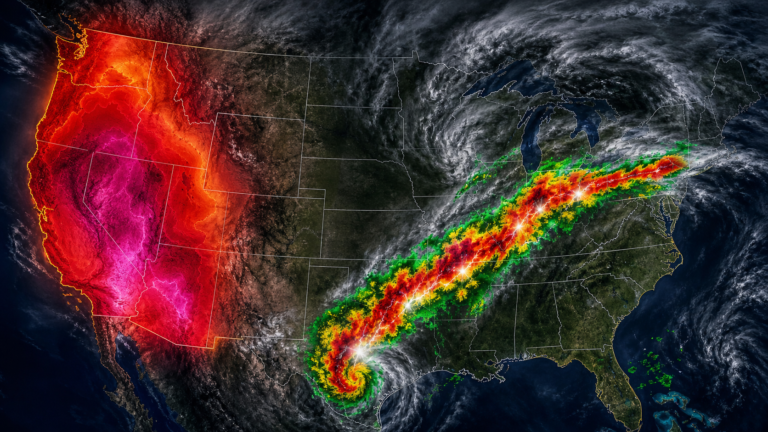
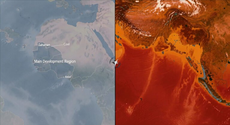
The first is El Niño, the periodic warming of surface waters in the central and eastern tropical Pacific Ocean. NOAA expects El Niño to develop and strengthen through the summer and into the peak of hurricane season, which runs from mid-September through October. El Niño alters upper-level wind patterns over the Atlantic basin, increasing what meteorologists call vertical wind shear: changes in wind speed and direction with height. Strong shear can tear apart a developing hurricane or prevent one from organizing in the first place. (For a refresher on how these storms form, see our hurricanes 101 guide.)
The second force is the Atlantic Ocean itself. Sea surface temperatures in the tropical Atlantic are running slightly warmer than normal this year, and warmer water provides the heat energy that fuels hurricanes. Trade winds also appear to be weaker than average across parts of the basin, another condition that can favor storm development.
Forecasters have concluded that El Niño’s suppressing influence will dominate the warmer Atlantic waters. “Although El Niño’s impact in the Atlantic Basin can often suppress hurricane development, there is still uncertainty in how each season will unfold,” said Ken Graham, director of NOAA’s National Weather Service. The outlook, the agency stressed, is based on large-scale climate patterns; it is not a landfall forecast.
What a Quieter Season Means for Coastal Communities
A below-normal forecast can bring a sense of relief, but emergency managers caution against letting that feeling harden into complacency. The Atlantic hurricane season still spans six months, from June 1 through November 30. Even a single landfalling storm can reshape a community.
For homeowners along the Gulf and Atlantic coasts, a quieter forecast does not necessarily translate to lower insurance premiums. The reinsurance market and catastrophe bond pricing respond to long-term risk models more than any single seasonal outlook. Coastal property owners are still navigating a market where coverage in high-risk zones has grown more expensive and, in some places, harder to obtain.
State and local emergency management agencies say they are treating 2026 the same as any other year: updating evacuation zones, stocking supplies, and running tabletop exercises. The message from officials is consistent: prepare the same way regardless of the seasonal numbers.
New Tools Watching the Atlantic in 2026
Even with fewer storms expected, NOAA has rolled out several forecasting upgrades that will matter whenever the next hurricane forms. For the first time, the National Hurricane Center’s forecast cone will display tropical storm and hurricane watches and warnings for inland counties, not just coastal areas. The change reflects the growing recognition that wind and flood threats extend well beyond the shoreline.
The agency is also testing an experimental version of the cone that incorporates uncertainty in both the direction and timing of a storm’s track, a refinement that could help convey the limits of a single forecast line. Hawaii, meanwhile, now has new storm surge watches, warnings, and peak surge graphics available on hurricanes.gov.
Behind the scenes, NOAA is putting more data into its models. A machine learning system now processes tail Doppler radar readings from Hurricane Hunter aircraft, capturing about 25 percent more high-quality meteorological data than before. Small uncrewed aircraft systems, essentially drones flown into the heart of storms, are feeding observations directly into the Hurricane Analysis and Forecast System, improving intensity forecast accuracy by roughly 10 percent. And the agency’s Flood Inundation Mapping tool, which shows high-resolution visualizations of flooded streets and neighborhoods, now covers 60 percent of the U.S. population and is on track to reach nearly 100 percent by late September.
“NOAA’s rapid integration of advanced technology, including AI-based weather models, drones, and next-generation satellite data, will deliver actionable science to safeguard the lives and livelihoods of the American people,” said NOAA Administrator Neil Jacobs.
It Only Takes One
The most quoted line from NOAA’s May 21 briefing came from Ken Graham: “It only takes one storm to make for a very bad season.” It is a phrase that has become a staple of hurricane preparedness messaging, and for good reason. Hurricane season in 1992 produced just seven named storms, a quiet year by any measure, but one of them was Andrew, a Category 5 storm that devastated South Florida and caused more than $27 billion in damage.
The lesson holds. A below-normal seasonal forecast is not a guarantee, and the difference between a quiet year and a catastrophic one can be a single storm track. Forecasters and emergency managers urge the same basic steps every season: know your evacuation zone, build or refresh an emergency kit with at least three days of supplies, review your insurance coverage, and have a communication plan for your household.
The 2026 Atlantic storm names are ready if and when they are needed: Arthur, Bertha, Cristobal, Dolly, Edouard, Fay, Gonzalo, Hanna, Isaias, Josephine, Kyle, Leah, Marco, Nana, Omar, Paulette, Rene, Sally, Teddy, Vicky, and Wilfred.
NOAA will update its seasonal outlook in early August, just ahead of the period when the Atlantic typically becomes most active. Until then, the forecast is clear-eyed and cautious: the odds favor fewer storms, but the ones that do form still demand full attention.
“Although El Niño’s impact in the Atlantic Basin can often suppress hurricane development, there is still uncertainty in how each season will unfold. That is why it’s essential to review your hurricane preparedness plan now. It only takes one storm to make for a very bad season.” — Ken Graham, NWS Director
“NOAA’s rapid integration of advanced technology, including AI-based weather models, drones, and next-generation satellite data will deliver actionable science to safeguard the lives and livelihoods of the American people.” — Neil Jacobs, NOAA Administrator