Tornadoes, Flash Floods, and a Heat Wave: The June 2026 Storm Outbreak Hitting Millions
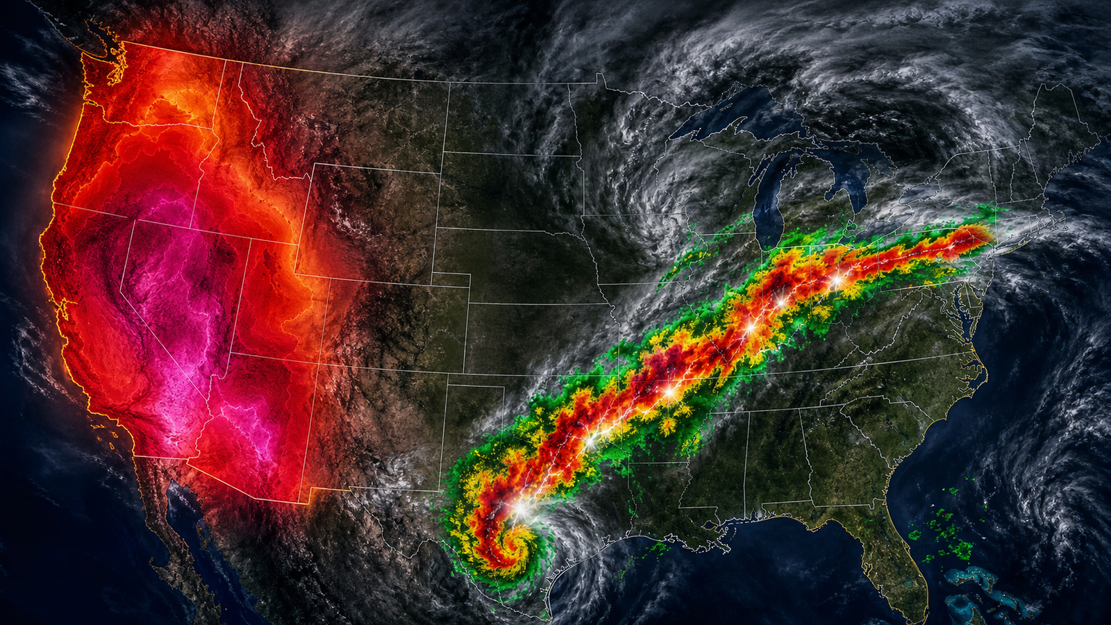
A powerful and sprawling weather system is carving a path of destruction across the United States this week, putting more than 90 million Americans under severe weather alerts from Texas to New York. Tornadoes have already killed multiple people in the Midwest. Flash floods are swamping cities in the South. And on the West Coast, a heat wave is pushing temperatures past 100°F.
Here is what is happening, region by region, and what to expect as the system keeps moving.
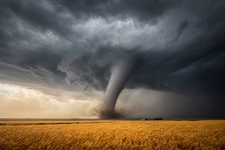
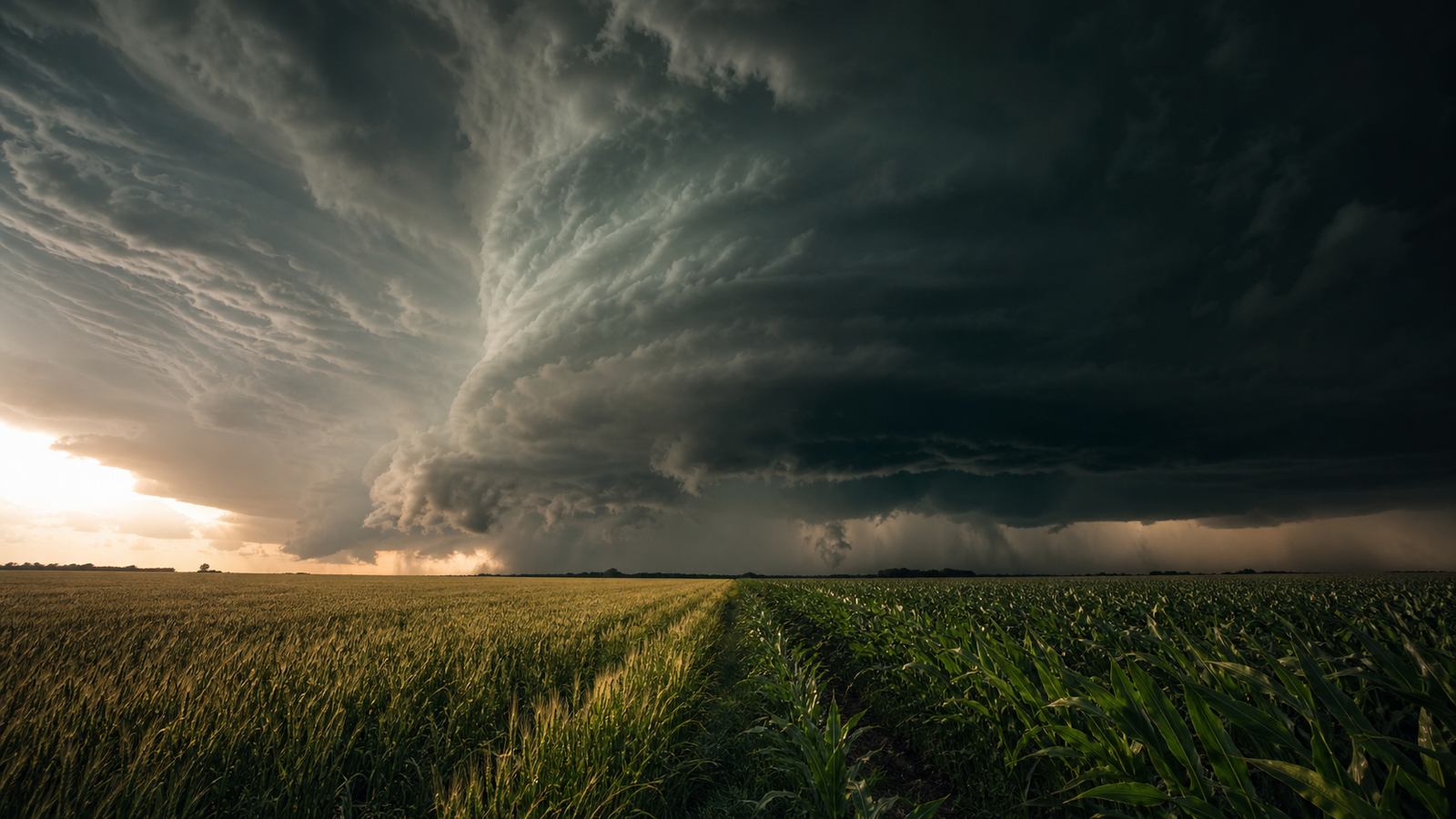
Illinois: A Deadly Tornado Outbreak
The storm system announced itself on June 11 with a violent tornado outbreak across northern and central Illinois. The National Weather Service in Chicago confirmed multiple strong to intense tornadoes, including one that struck the city of Streator, roughly 90 miles southwest of Chicago. Emergency crews spent hours assessing damage and conducting search operations. CNN reported multiple fatalities.
Illinois is no stranger to tornadoes. The state recorded 140 tornadoes in a single recent year, more than any other state. As we covered in our analysis of why Illinois leads in tornado counts, a combination of geography and atmospheric patterns makes the state a frequent target. This outbreak was a brutal reminder of that pattern.
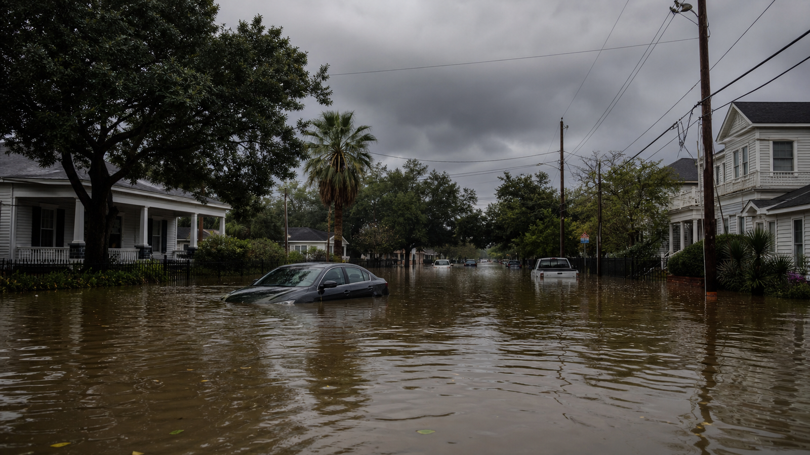
Texas and the Gulf Coast: Flash Floods Overwhelm Cities
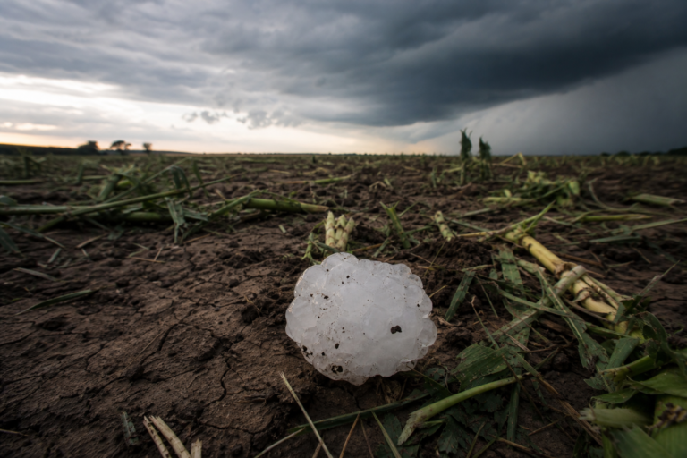
By June 15, the system had shifted south. Flood watches went into effect for about 20 million people stretching from central and southern Texas through Louisiana and into central Mississippi.
The rainfall rates were staggering. The National Weather Service reported rainfall intensities of 2 to 5 inches per hour in some areas. Total accumulations of 3 to 6 inches were expected across the region, with isolated pockets receiving more than 8 inches. Houston, already one of the most flood-vulnerable major cities in the country, faced particularly dangerous conditions.
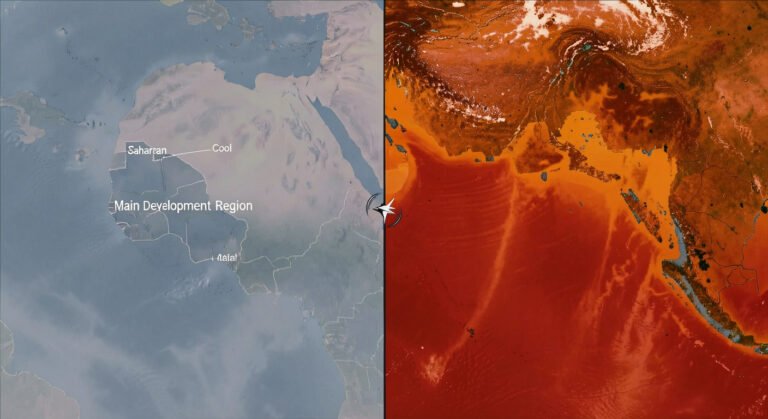
The heavy rain was fueled by a tropical disturbance — essentially an early-stage, loosely organized cluster of thunderstorms drawing moisture from the Gulf of Mexico. Even an unorganized system can dump enormous amounts of water when it stalls over a region with warm, humid air to feed on.
Cities under flood watches on Monday included San Antonio, Austin, Corpus Christi, Houston, Galveston, and Beaumont in Texas; Lake Charles and Monroe in Louisiana; and Jackson, Mississippi. Forecasters warned that flood watches would likely be extended into Tuesday.
What’s Coming Next: Midwest and Mid-Atlantic in the Crosshairs
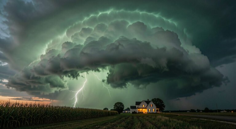
The system is not finished. Forecast models show the severe threat shifting east through the middle of the week.
On Wednesday, June 17, an estimated 39 million people from eastern Kansas to central Ohio will be in the risk zone. The hazards include damaging straight-line winds, large hail, and the potential for additional tornadoes. Major cities in the path include Kansas City, St. Louis, Chicago, Indianapolis, and Columbus.
By Thursday, the threat moves to the Mid-Atlantic, with roughly 48 million people from eastern Kentucky to Long Island under risk — including Charleston, Richmond, Washington D.C., Baltimore, Philadelphia, and New York City.
Read our hurricane explainer to understand how tropical disturbances can evolve into more organized severe weather systems.
Meanwhile, the West Coast Bakes
While the eastern half of the country deals with storms, the West Coast is facing the opposite problem. A heat dome is building from northern Washington down through California’s Central Valley, with temperatures ranging from the mid-80s to above 100°F. A dozen daily temperature records could be challenged or broken, including in the Portland and Seattle metro areas — cities where air conditioning is far from universal.
Extreme heat is the deadliest weather phenomenon in the United States. It kills more people annually than hurricanes, tornadoes, and floods combined.
How to Stay Safe
If you are in the path of this storm system, here are the most important things to know.
For tornadoes: Have multiple ways to receive warnings — a weather radio, phone alerts, and local news. Know where your safe shelter is before a warning is issued. A basement or interior room on the lowest floor, away from windows, is best.
For flash floods: Never drive through flooded roads. It takes just 12 inches of moving water to sweep away a car. Most flood deaths occur in vehicles. If you are in a flood-prone area, be ready to move to higher ground quickly.
For extreme heat: Stay hydrated, limit outdoor activity during peak afternoon hours, and check on elderly neighbors. Know the signs of heat exhaustion: heavy sweating, weakness, dizziness, nausea. If symptoms progress to heat stroke — hot, dry skin, confusion, loss of consciousness — call 911 immediately.
For official updates, monitor the National Weather Service at weather.gov and your local emergency management office. The NOAA Storm Prediction Center at spc.noaa.gov provides severe weather outlooks updated multiple times per day.
Check our drought coverage for context on how the heat wave fits into broader climate patterns affecting the continental US this summer.