El Niño Is Officially Here — And It Could Be Historic
The Pacific Ocean just flicked a switch, and the whole planet feels it.
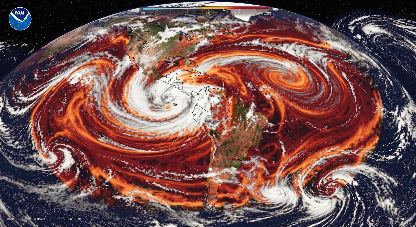
On June 11, NOAA’s Climate Prediction Center made it official: El Niño conditions have arrived in the tropical Pacific. Not a maybe, not a “watch.” This is a full-blown declaration. Sea surface temperatures in the key monitoring region have climbed well above the threshold, and the atmosphere is starting to fall in line — the trade winds are slacking off, the convection is shifting east. That’s the double-check that turns “possible El Niño” into “yep, it’s here.”
And here’s the kicker: this one could be a monster.
The 63% number that should grab your attention
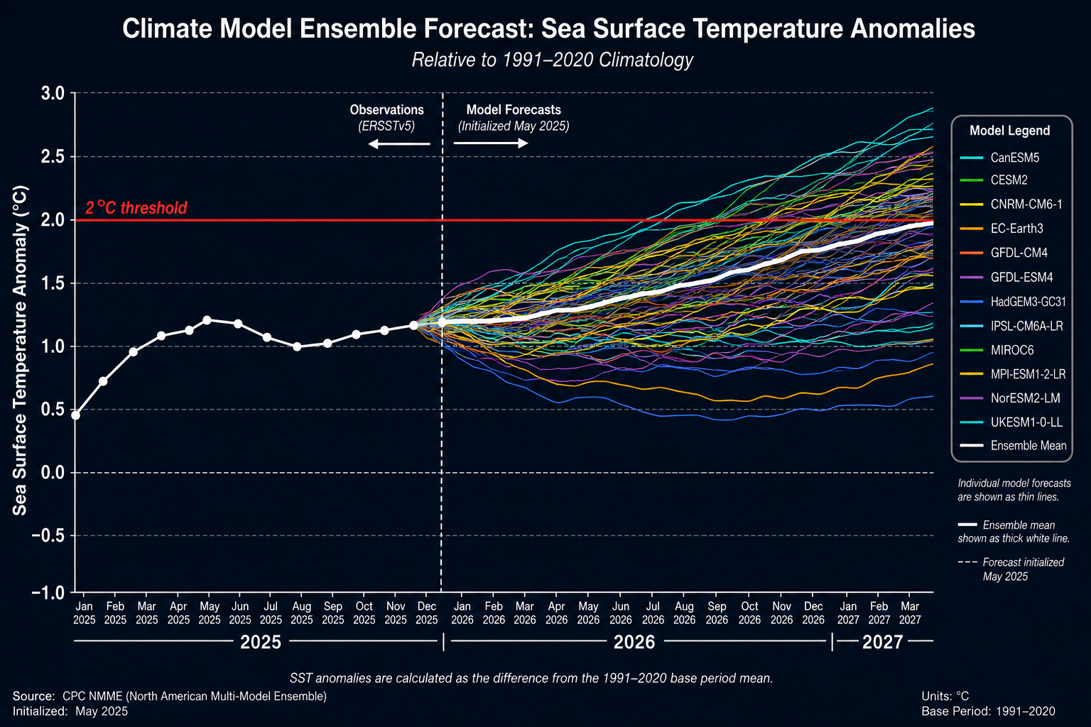
NOAA’s forecasters give it a 63% chance that this El Niño will push sea surface temperatures more than 2°C above average. That’s not just “strong.” That’s “very strong.” That’s the threshold that separates memorable El Niños from historic ones. The kind scientists pull up in textbooks.
The only other El Niño in the modern record to hit that mark was 1997 — the legendary super El Niño that drowned California in rain, triggered drought in Indonesia, and reshaped weather patterns across the globe for a full year. Some comparisons are already being drawn. But here’s the uncomfortable truth the experts keep repeating: no two El Niños are alike. And this one’s unfolding in a climate system that looks nothing like 1997.
Wait, refresh me: what actually is El Niño?
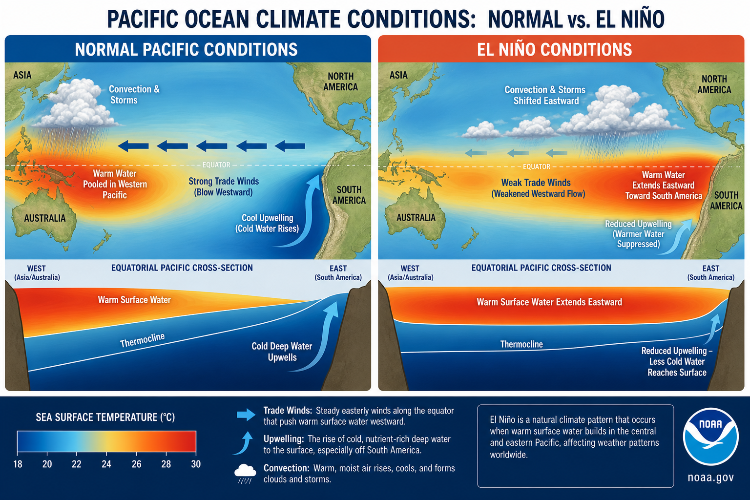
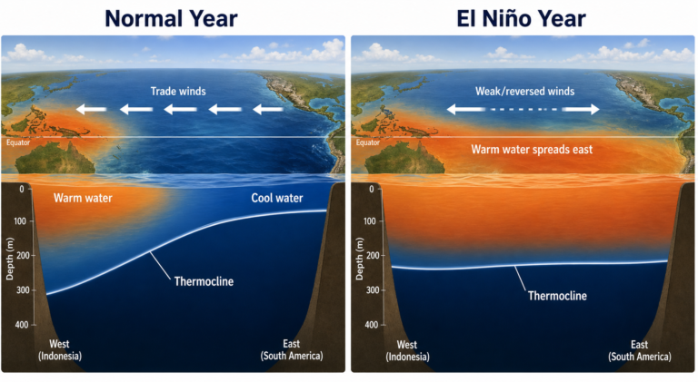
Quick refresher, because the term gets thrown around a lot. El Niño is part of a natural climate cycle called ENSO — the El Niño-Southern Oscillation. Normally, steady trade winds push warm surface water toward Asia, allowing cooler, nutrient-rich water to well up along the Pacific coast of South America. During El Niño, those trade winds stall out. Warm water sloshes back eastward, and the whole engine of tropical weather shifts with it.
That might sound like a Pacific problem. It’s not. The tropical Pacific is the planet’s largest source of heat energy, and when you move that heat around, the atmosphere responds everywhere. Australia gets drier. The southern US gets wetter. The jet stream contorts like a loose garden hose. You feel it whether you live in Seattle or São Paulo. For a deeper dive into the mechanics, check our explainer on how El Niño works.
What this could mean for your winter — and your summer
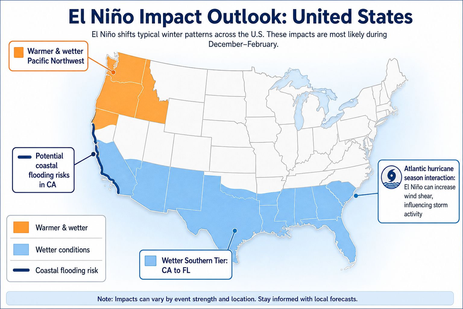
If you’re in the Pacific Northwest, forecasters are already eyeing a warmer-than-average winter. The typical El Niño pattern shoves the jet stream south, which tends to shield the Pacific Northwest from the coldest Arctic air while sending more moisture toward California and the Gulf states. For California, that could mean some desperately needed rain — or it could mean flooding and mudslides, depending on how the atmospheric rivers line up.
The West Coast also gets a double whammy from the ocean side. Warmer coastal waters fuel more algae blooms, some of which produce toxins that can shut down crabbing and shellfish fisheries. Coastal communities are already staring down higher risks of “king tides” and storm surge, especially during winter high tides.
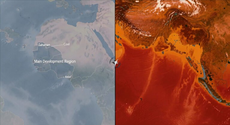
But here’s where things get weird. El Niño usually suppresses Atlantic hurricane activity by cranking up wind shear in the Atlantic basin. This year? That effect might be blunted — because Atlantic sea surface temperatures are already near-record warm. It’s like putting a lid on a pot that’s already boiling over. The lid might slow it down, but it’s not going to stop it. For more context on how Atlantic heat plays into this, read our breakdown of the 2026 hurricane season outlook.
Drought relief for some, flooding for others — the uneven hand of El Niño
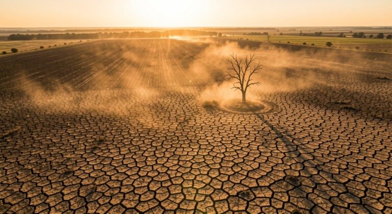
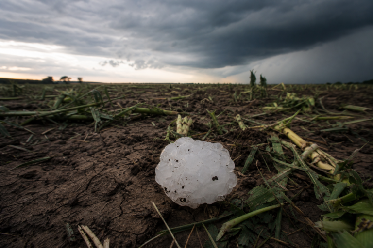
El Niño giveth, and El Niño taketh away. For the drought-stricken Southeast and parts of the Plains, this pattern could finally bring the rain that’s been missing for months. But for Indonesia, eastern Australia, and parts of Africa, it typically means the opposite — drier conditions, worse fire seasons, stressed food production.
And the Great Lakes region? It just depends. Some El Niños bring them a mild winter. Others skip right over them. That uncertainty is the throughline of the entire forecast.
“No one really knows what to expect this year”
That’s not my line — it’s a sentiment you’ll hear from climate scientists who study this stuff for a living. Sure, the models are better than they were in 1997. But this El Niño is forming on top of an ocean that’s already the warmest it’s ever been. The background state of the climate has shifted. The rules of the game are the same, but the playing field is different.
El Niños typically last 9 to 12 months. That means this one will shape weather patterns through fall, winter, and into next spring. It’ll affect how much you pay for heating, whether your region sees drought relief or wildfire risk, and what next year’s hurricane season looks like.
The declaration is official. The forecast is written. Now we just watch what the Pacific does. And if you ask the people who track this for a living — they’re watching closer than ever.
—
Sources: NOAA CPC ENSO Diagnostic Discussion, The New York Times, The Guardian, Forbes, Union of Concerned Scientists Climate Blog.