What Is a Derecho? The Inland Hurricane Explained Simply
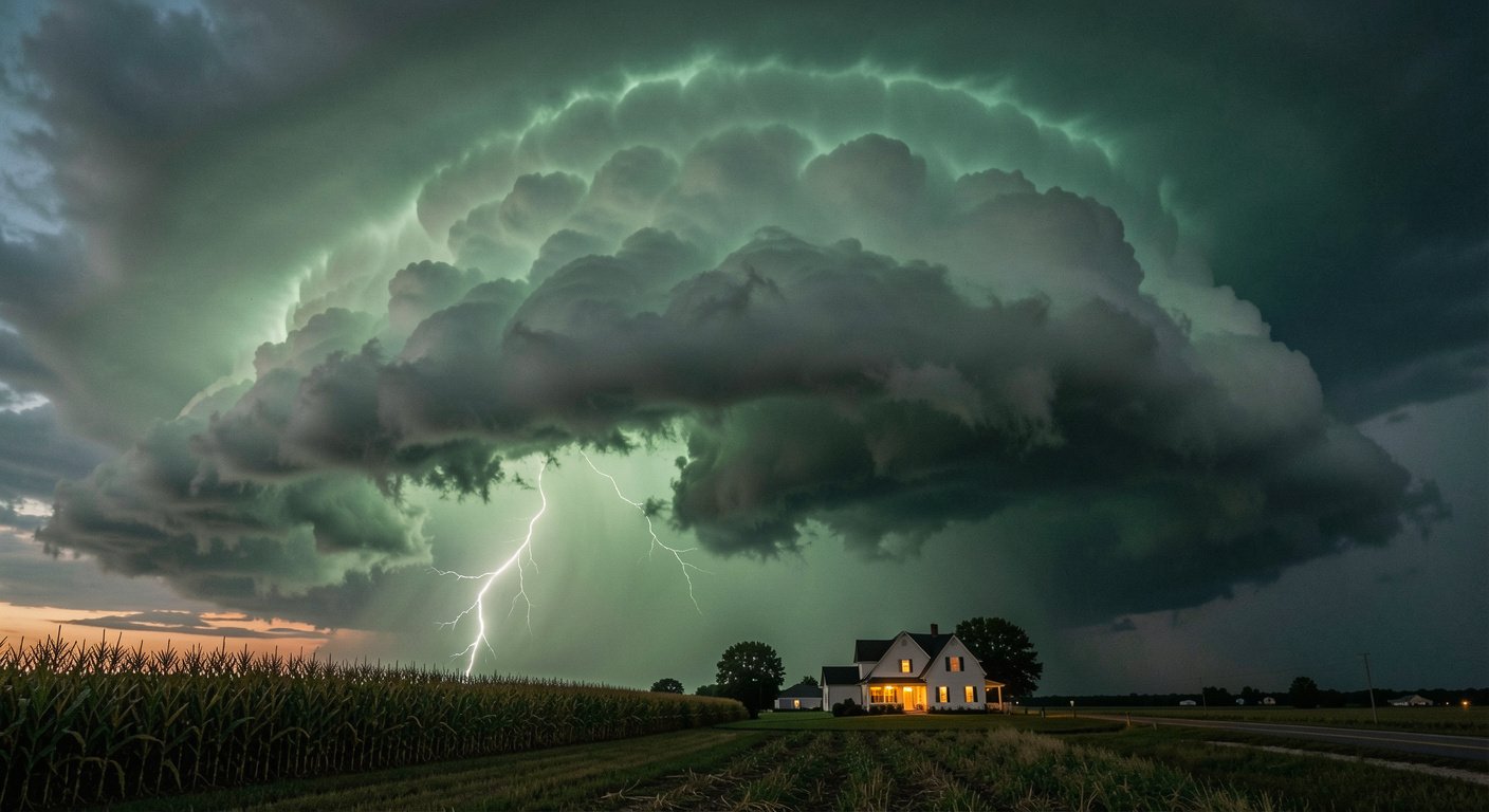
On August 10, 2020, residents of Cedar Rapids, Iowa, heard the wind pick up. They expected it to pass in 10 or 15 minutes, like any severe thunderstorm. Instead, the wind screamed for nearly an hour.
The storm left the city without half its trees, forced a nuclear plant to close, and carved a 770-mile path from South Dakota to Ohio. It was a derecho, the costliest thunderstorm in American history.
What a Derecho Actually Is
Derecho is Spanish for “straight ahead.” University of Iowa physicist Gustavus Hinrichs coined the term in 1888 to distinguish these straight-line windstorms from tornadoes, which spin. The National Weather Service defines a derecho as a widespread, long-lived windstorm from a fast-moving thunderstorm complex whose damage path spans at least 250 miles, with gusts of 58 mph or stronger along most of it and at least three separated 75-mph reports [SOURCE: https://www.weather.gov/lmk/derecho] [SOURCE: https://en.wikipedia.org/wiki/Derecho].
Peak gusts have reached 140 mph, matching a Category 4 hurricane. Forward speeds often hit 60 to 70 mph, consuming a county in minutes. The United States averages one or two derechos a year, roughly 70 percent between May and August, and they are rare west of the Great Plains [SOURCE: https://www.weather.gov/lmk/derecho].
Meteorologists call them “inland hurricanes.” The name is imperfect: derechos form over land, not warm ocean water. But it captures the threat with the gravity it deserves [SOURCE: https://www.nationalgeographic.com/environment/article/what-is-a-derecho-and-why-is-it-so-destructive].
The wind screamed for nearly an hour. When it stopped, the 2020 Midwest derecho had cut a 770-mile path and caused $11.2 billion in damage.
Why Derechos Form
Picture a pot of water on a stove with the lid on: heat builds and steam is trapped. Lift the lid and everything boils over. A derecho starts the same way [SOURCE: https://www.nesdis.noaa.gov/about/k-12-education/severe-weather/what-is-derecho].
The “lid” is a cap, a warm layer holding storms down while instability accumulates. When the cap breaks, often from a cold front, thunderstorms erupt. Rain-cooled downdrafts crash down and spread outward: this is a downburst [SOURCE: https://www.weather.gov/lmk/derecho].
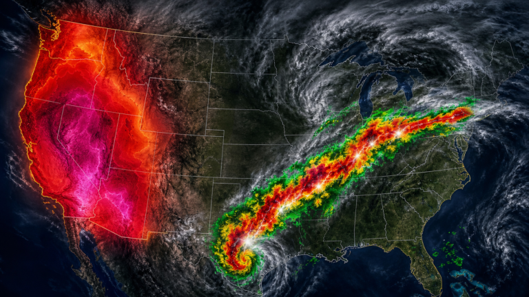
Downbursts feed a cycle. Cool air at the surface shoves warm, moist air upward, seeding new storms. On radar, the storm line bends into a “bow echo,” like an archer’s bow.
The fastest winds live at the bow’s center. Strong vertical wind shear, a 2025 University of Oklahoma study found, is the ingredient that locks the storm into a sustained engine [SOURCE: https://www.nesdis.noaa.gov/about/k-12-education/severe-weather/what-is-derecho] [SOURCE: https://en.wikipedia.org/wiki/Derecho].
How a Derecho Affects People
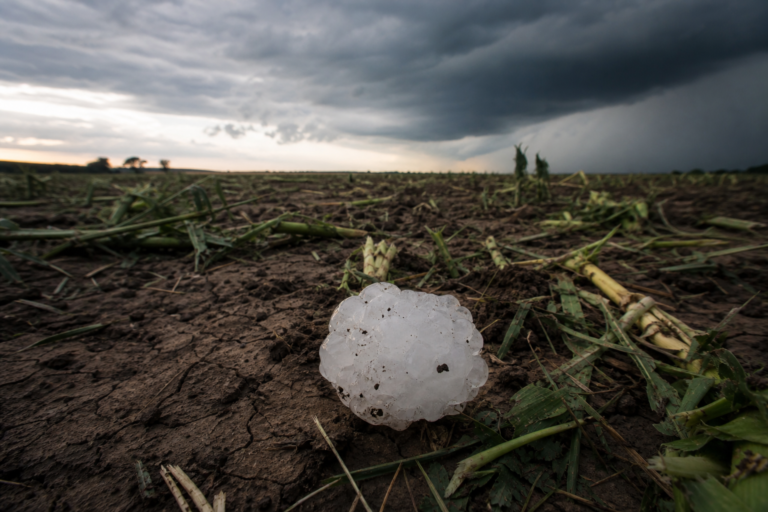
The 2020 derecho hit 14 million acres of Iowa farmland, flattening 3.57 million acres of corn and 2.5 million acres of soybeans in an afternoon. Crops nurtured all summer vanished before sunset [SOURCE: https://www.npr.org/2021/08/10/1026499719/midwest-derecho-iowa-2020-costliest-storm].
In Cedar Rapids, streets were impassable for days and the Duane Arnold nuclear plant’s cooling towers were destroyed. Some neighborhoods went without power for weeks during a heat wave. Total damage: $11.2 billion [SOURCE: https://www.washingtonpost.com/weather/2020/10/17/iowa-derecho-damage-cost/].
Nearly half of all derecho deaths happen in vehicles or boats. Trees fall onto cars and semi-trucks blow over on highways. Boaters caught by sudden wind and waves drown before reaching shore [SOURCE: https://www.noaa.gov/jetstream/derecho-safety].
The 2012 derecho killed 22 people and left more than 5 million without power during a punishing heat wave. That storm brought the word “derecho” into the public vocabulary [SOURCE: https://www.nationalgeographic.com/environment/article/what-is-a-derecho-and-why-is-it-so-destructive].
Nearly half of all derecho fatalities occur in vehicles or boats. A Severe Thunderstorm Warning should be treated with the same urgency as a Tornado Warning.
Why Derechos Matter Now
Climate research suggests derechos may grow more frequent in the Midwest and more intense at the high end, even if overall thunderstorm numbers decline. The peak season may be expanding earlier in the year [SOURCE: https://www.opticweather.com/blog/what-are-derecho-storms-and-why-are-they-called-inland-hurricanes].
In July 2024, a derecho spawned 56 tornadoes across Iowa, Illinois, and Indiana, with 48 in Illinois alone, a state record. Four touched down inside Chicago city limits. In April 2025, another derecho cut power to more than 700,000 people across the Ohio Valley and interior Northeast [SOURCE: https://www.weather.gov/lot/2024_07_15_Derecho] [SOURCE: https://www.accuweather.com/en/severe-weather/what-is-a-derecho-the-inland-storm-that-hits-like-a-hurricane/328474].
What You Can Do
No specific “derecho warning” exists; these storms are covered by Severe Thunderstorm Warnings. Treat them with the same urgency as a Tornado Warning. The storm moves at highway speeds and conditions can turn catastrophic in minutes [SOURCE: https://www.noaa.gov/jetstream/derecho-safety].
Before the warm season, check forecasts daily and enable emergency alerts, keeping a NOAA Weather Radio as backup. Know your shelter: a basement or interior room on the lowest floor, away from windows. If you camp, boat, or drive through the Midwest or Ohio Valley between May and August, plan ahead [SOURCE: https://www.noaa.gov/jetstream/derecho-safety].
When a warning comes, go indoors immediately and stay away from windows. In a car, pull over away from trees and power lines, stay buckled, and cover your head. On a boat, head for shore at the first dark shelf cloud.
After the storm, stay inside until officials confirm it is safe. Downed power lines are hidden killers [SOURCE: https://www.acurite.com/blogs/weather-101/4-safety-tips-for-derecho-windstorms].
Derechos are rare. But when they come, they come fast. Knowing what to look for and what to do is the difference between being caught off guard and being ready.
Stay informed, stay prepared. Follow NatureWeatherHub for clear, accurate explainers on the weather that shapes our world. Sign up for the newsletter to receive storm alerts and preparedness guides in your inbox.
Sources
- NWS Louisville: Derecho Definition, Formation Stages, Climatology
- Wikipedia: Derecho Criteria, Classification, Etymology
- National Geographic: What Is a Derecho and Why Is It So Destructive?
- NOAA NESDIS: What Is a Derecho? Downburst Mechanism Explained
- NPR: 2020 Midwest Derecho, the Costliest Thunderstorm in US History
- Washington Post: Iowa Derecho Damage and Cost Analysis
- NOAA JetStream: Derecho Safety, Fatality Statistics, and Preparedness
- NWS Chicago: July 15, 2024 Derecho and Record Tornado Outbreak
- AccuWeather: Derecho Danger, April 2025 Event and Comparisons
- Optic Weather: Inland Hurricanes, Climate Change and Derecho Research
- AcuRite: 4 Safety Tips for Derecho Windstorms