Two rivers of air, moving at different speeds high above the American plains, create the invisible seed of the most violent storm on Earth.
Understanding how tornadoes form starts with something you cannot see. When winds at different heights blow at different speeds, they twist the air between them into a horizontal, spinning tube. At ground level, a southwest wind at 5 miles per hour meets an upper-level southeast wind at 25 miles per hour.
The difference rolls the air like a rolling pin in the sky. Most of these invisible tubes dissipate harmlessly. But when a thunderstorm moves overhead, everything changes.
What Is a Tornado?
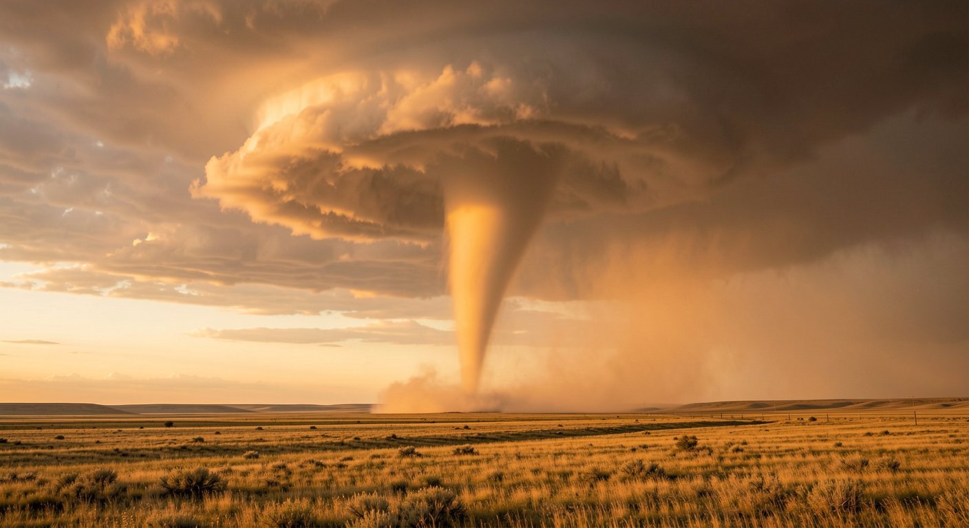
A tornado is a violently rotating column of air connecting a thunderstorm to the ground. Most tornadoes clock in under 110 miles per hour, but the most extreme, learned from exceptional storms like the Bridge Creek, Oklahoma tornado of May 3, 1999, reached approximately 302 miles per hour by mobile Doppler radar: the highest wind speed ever recorded on Earth.
Scientists call the parent circulation a mesocyclone, the rotating updraft inside a supercell thunderstorm that Doppler radar can detect 20 to 60 minutes before a tornado touches down. Not every rotating storm produces a tornado, and understanding why is the central puzzle of tornado science.
The Recipe: Four Ingredients
The United States sees about 1,200 tornadoes every year, more than anywhere else on Earth. The reason comes down to four ingredients and geography.
Warm, moist air from the Gulf of Mexico flows north across the plains. Cold, dry air from Canada pushes south. When they collide along a weather front, they create a boundary of unstable air.
The jet stream adds wind shear: the change of wind speed and direction with height that starts the air spinning. A trigger, a cold front, a dryline, or daytime heating, forces the unstable air upward. When all four come together over flat terrain, the stage is set for the storms that produce tornadoes. No other country has this combination of geography and atmospheric ingredients.
How Tornadoes Form: Step by Step
The process of tornado formation explained follows a sequence that Doppler radar tracks from start to finish.
Wind shear creates the seed. At the surface, a southwest wind at 5 miles per hour meets an upper-level southeast wind at 25 miles per hour. The difference creates a horizontal tube of rotating air stretching for miles.
A developing thunderstorm’s updraft then tilts that tube upright, turning a rolling pin into a spinning column inside the storm. Meteorologists call this rotating updraft a mesocyclone. It can stretch up to 10 miles wide and 50,000 feet tall, lasting over one hour.
As the mesocyclone tightens, a lowered, rotating wall cloud forms beneath the storm base. Storm spotters watch this wall cloud because it signals a tornado may follow within minutes.
The rear flank downdraft, a rush of cool, dry air descending behind the rotation, focuses the spin tighter until a funnel touches down. Eventually, that same downdraft cuts off the tornado’s warm air supply, and it dissipates. A tornado may last seconds or over an hour, carving a path from a few yards to 2.6 miles wide, as the El Reno, Oklahoma tornado did on May 31, 2013.
What Scientists Still Don’t Know
Only about 20 percent of supercell thunderstorms ever produce a tornado. Nearly 20 percent of all tornadoes come from QLCS storms instead, which are weaker and shorter-lived.
Meteorologists can identify the conditions and watch rotation develop on radar. But why one supercell drops a tornado while the next one, in nearly identical conditions, does not, is an open question. The exact role of temperature gradients, moisture boundaries, and downdraft dynamics is still being studied. Every spring, field teams deploy mobile radar units into the path of developing storms, chasing data that will one day close this gap in tornado science.
The EF Scale: Measuring Destruction
Tornado intensity is rated on the Enhanced Fujita scale, which uses 28 damage indicators and 8 degrees of damage to estimate wind speeds after the storm. The scale has been operational since February 1, 2007. EF scale wind speeds are damage-based estimates, not direct measurements.
| Rating | Wind Speed | Frequency | Damage |
|---|---|---|---|
| EF0 | 65 to 85 mph | 52.82% | Tree branches snapped |
| EF1 | 86 to 110 mph | 32.98% | Roof surfaces peeled, mobile homes overturned |
| EF2 | 111 to 135 mph | 8.41% | Roofs torn off houses, large trees snapped |
| EF3 | 136 to 165 mph | 2.18% | Entire stories of homes destroyed |
| EF4 | 166 to 200 mph | 0.45% | Well-built homes leveled |
| EF5 | Over 200 mph | 0.05% | Homes lifted off foundations and disintegrated |
More than 95 percent of all tornadoes are EF2 or weaker. EF4 and EF5 tornadoes account for only 0.5 percent combined but cause the majority of tornado deaths. The Joplin, Missouri EF5 of May 22, 2011, killed 158 people and caused $2.8 billion in damage, making it the deadliest modern tornado.
When and Where
Tornado Alley stretches from Texas through Oklahoma, Kansas, Nebraska, and into South Dakota, but tornadoes have been recorded in all 50 states. The pattern shifts with the seasons: the Southeast in winter, the Plains in spring, the Midwest and northern states in summer.
Peak hours are 4 to 9 p.m., when daytime heating has destabilized the atmosphere the most. The deadliest tornado in US history, the Tri-State Tornado of March 18, 1925, killed 695 people across a 243-mile path, long before modern radar existed.
Staying Safe
A Tornado Watch means conditions are favorable; stay alert and monitor forecasts. A Tornado Warning means a tornado has been spotted or indicated by radar, and you need shelter immediately.
The safest place is a basement or interior room on the lowest floor, away from windows. Mobile homes are extremely vulnerable and account for most tornado deaths. Never shelter under a highway overpass; wind speeds increase through the narrow opening.
About 60 people die in US tornadoes each year, most from flying debris. Wireless Emergency Alerts push warnings to cell phones, giving people an extra layer of warning. With modern detection and alert systems, properly sheltered people survive even the worst tornadoes at a rate of 99 percent.
A tornado is a violently rotating column of air connecting a thunderstorm to the ground. Winds inside the strongest tornadoes can exceed 300 mph. Only about 20% of supercell thunderstorms ever produce a tornado, and scientists still do not fully understand why.
- The US sees about 1,200 tornadoes per year, more than anywhere else on Earth
- Tornadoes form when wind shear creates horizontal rotation that a thunderstorm updraft tilts vertical
- Doppler radar can detect the parent circulation 20 to 60 minutes before touchdown
- 95% of tornadoes are EF2 or weaker; EF4/EF5 account for only 0.5% but cause most deaths
- A Tornado Watch means conditions are favorable; a Warning means take shelter immediately