What Is Happening
Meteorologists at the National Oceanic and Atmospheric Administration issued an urgent warning on June 20, 2026: a slow-moving storm system was poised to deliver “impactful flash floods and severe storms” across the Plains and Midwest. By the following day, the agency’s National Water Center confirmed that river flooding was already underway from the Central and Southern Plains into the Ohio Valley, with fresh convection churning across the Middle Mississippi Valley. Scattered moderate to isolated major river flooding was forecast for central Kansas and Missouri through midweek.
For many communities in Iowa and Illinois, the warning arrived on ground that was already saturated. In early April 2026, a separate system had dumped 3 to 6 inches of rain across northern Indiana, northwest Ohio, and southern Michigan in less than a week. Those totals exceeded the normal monthly rainfall for April, which typically runs between 3.5 and 3.75 inches. Rivers reached minor to moderate flood stage, farm fields turned into shallow lakes, and the soil never fully dried out before the next round of storms arrived.
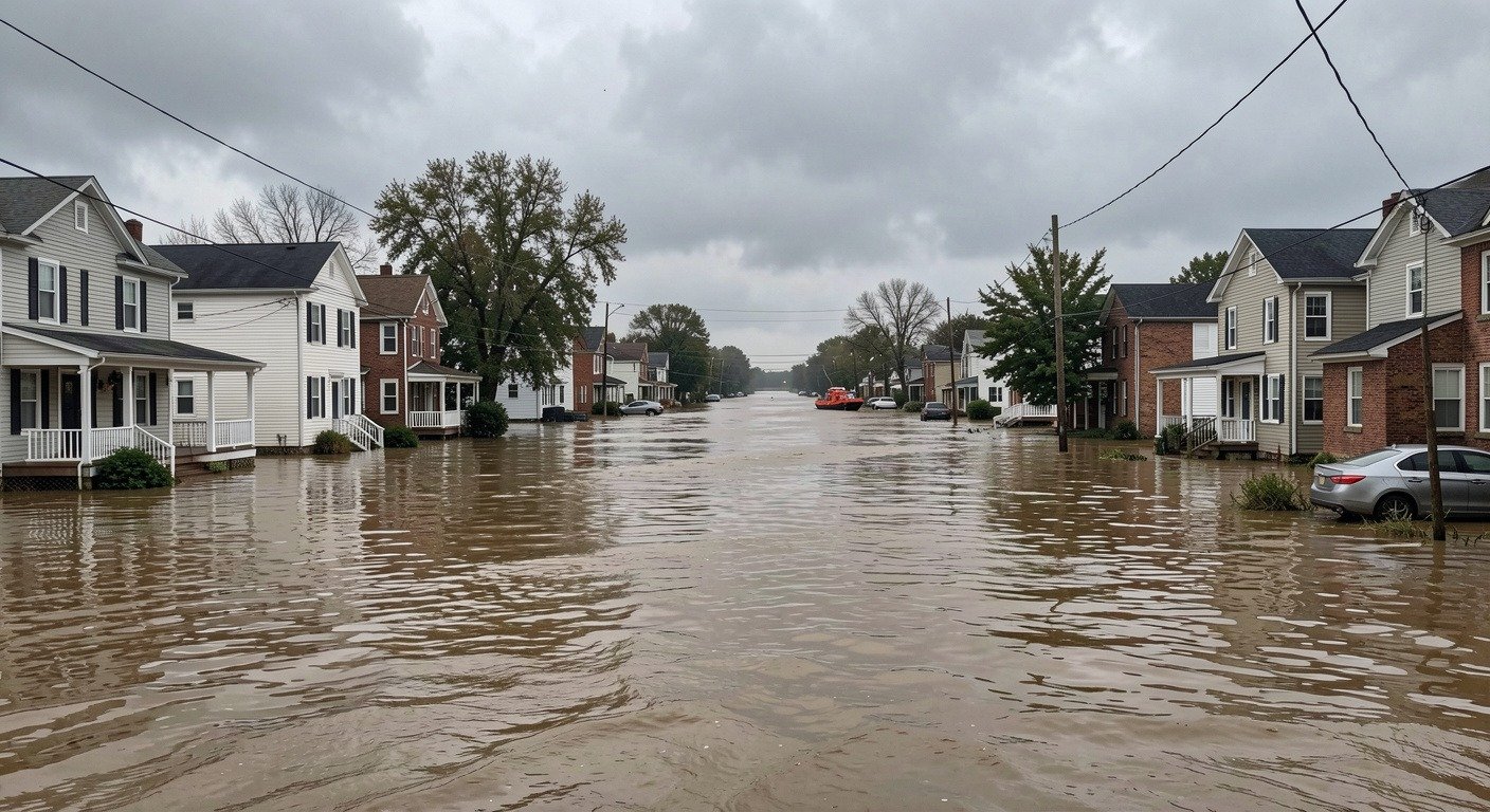
The current flooding has not yet matched the devastation of June 2024, which stands as the most extreme Midwest flood in recent memory. During that event, record rainfall of 6 to more than 15 inches fell across southern Minnesota, northwestern Iowa, and southeastern South Dakota in 48 to 72 hours. Sixteen NOAA river gauges broke all-time records, some by as much as 7 feet. The Big Sioux River at Sioux City, Iowa, climbed to roughly 45 feet, surpassing its previous record by 7 feet. The Rock River at Rock Valley hit 27 feet, well past its major flood stage of 19 feet, forcing 4,000 residents to evacuate after a levee failed. In Minnesota, the Rapidan Dam was pushed to the brink of “imminent failure.”
As of this week, forecasters are watching many of the same rivers that surged in 2024: the Big Sioux, Little Sioux, Des Moines, Cedar, Iowa, Rock, Minnesota, and the Mississippi itself. In 2024, the Mississippi River mainstem stayed above flood stage at La Crosse, Wisconsin, for 18 consecutive days, second only to the Great Flood of 1993, which held the river high for 20 days.
For the latest hydrologic forecasts and real-time river gauge data, visit the NOAA National Water Prediction Service.
Why It Happens
The engine driving these floods is a recurring formula, and it starts with moisture. Slow-moving frontal boundaries stall over the Midwest, drawing warm, water-laden air north from the Gulf of Mexico. When that moisture encounters the right atmospheric lift, such as a low-pressure system or a strong temperature contrast, it condenses and falls as heavy, sustained rain. The simple version: warm air holds more water. The Clausius-Clapeyron relationship states that for every 1 degree Celsius of warming, the atmosphere can hold roughly 7 percent more moisture. When released as rain, storms become heavier and more intense.
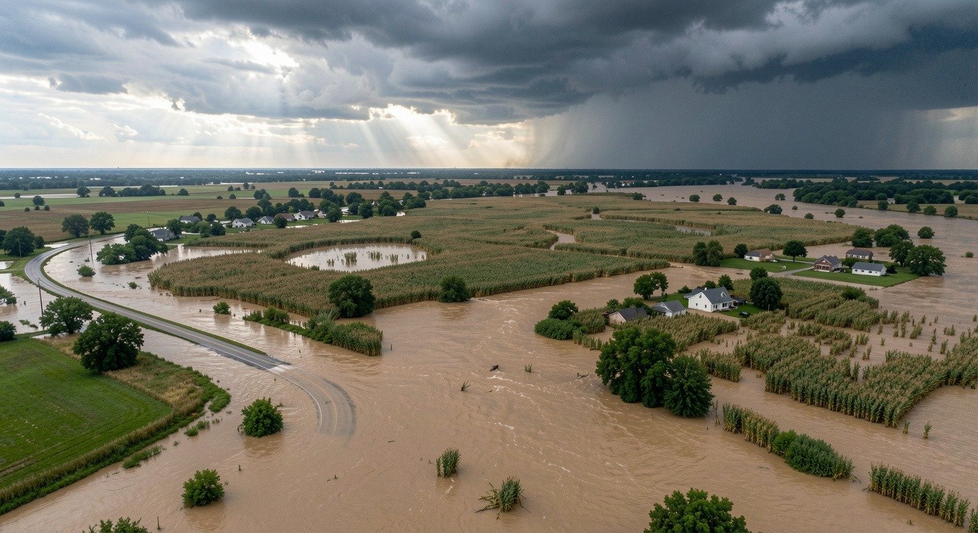
But heavy rain alone does not always produce a flood. What turns a heavy rain event into a disaster is what was already in the ground. Before the June 2024 floods, the region had received 150 to 200 percent of normal rainfall in the preceding months. The April 2026 rains created similar conditions this year. When soil is already saturated, it cannot absorb additional water. The rain has nowhere to go except into rivers and streams, which rise quickly and stay high.
NASA’s SPoRT soil moisture data, which the National Weather Service uses in its forecasts, showed that the landscape across the upper Midwest effectively lost its ability to function as a sponge. Every additional inch of rain translated almost directly into runoff. The numbers bear this out: from 1958 to 2016, the amount of precipitation falling in the heaviest 1 percent of storms in the Midwest increased by 42 percent, according to the Great Lakes Integrated Sciences and Assessments program at the University of Michigan. The region has recorded a 23.6 percent increase in the frequency of extreme precipitation events and a 5.1 percent increase in their intensity.
For more on how a warming atmosphere changes severe weather, read our article on how climate change is making hailstorms bigger.
How It Affects People
Farmers and Food
The Midwest is the breadbasket of the United States, and floodwaters do not respect planting calendars. The 2019 floods alone prevented nearly 20 million acres of insured planting. The 2008 floods across Iowa, Illinois, Indiana, and Missouri caused cumulative crop losses of roughly 148 million bushels. In 1993, crop losses exceeded $5 billion. Beyond the immediate loss of a season’s work, repeated flooding pushes farm families toward bankruptcy and contributes to rising rates of anxiety and depression in rural communities.
Infrastructure and Clean Water
When rivers rise, roads become rivers. The 2024 floods collapsed a railroad bridge over the Big Sioux River, breached levees in Rock Valley, Iowa, and pushed the Rapidan Dam in Minnesota to the edge of failure. Wastewater treatment plants are routinely overwhelmed, releasing untreated sewage into waterways. During past floods, a plant shutdown near High Ridge, Missouri, left 20,000 residents without drinking water. These failures compound the immediate disaster with public health risks that linger long after the water recedes.
Mental Health and Community Stress
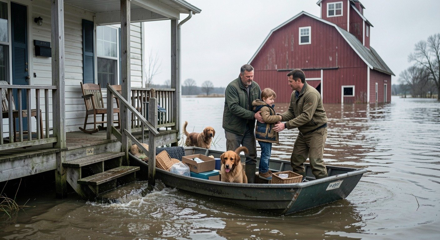
Some Midwest towns have now endured three or four major floods in a single generation. Each evacuation, each cleanup, each insurance claim wears on people in ways that are harder to measure than a river gauge reading but no less real. The decision to rebuild or to leave becomes a question families have to answer repeatedly, and the communities that can least afford to lose population are often the ones hit hardest.
Why It Matters Now
The question people living along these rivers are asking is straightforward: Are so-called 100-year floods now happening every five or ten years? The data suggest the labels may no longer match reality. The Great Flood of 1993 caused roughly $20 billion in damages. The 2008 floods caused about $15 billion. These events were once considered generational; now they arrive close enough together that a single family can experience several in a lifetime.
For an overview of the broader extreme weather picture this year, see our 2026 hurricane season coverage.
There is also a less discussed but critical factor: flood protection is often zero-sum. A levee that shields one town pushes water downstream to the next. Communities in Chester, Grand Tower, and Thebes, Illinois, have watched Mississippi River levels rise as upstream protections redirect the river’s energy. The policy questions this raises, about who gets protected and who bears the cost, are uncomfortable but increasingly urgent.
What We Can Learn
The first lesson is that soil moisture matters as much as rainfall. When the ground is already wet, even a moderate rainstorm can trigger dangerous flooding. The National Weather Service’s integration of NASA satellite soil moisture data into its hydrologic forecasts represents real progress, but that information is only useful if communities and individuals act on it.
The second lesson is that where and how we build shapes who suffers. Floodplain development, levee design, and disaster recovery policy all influence whether the next flood is a headache or a catastrophe. Federal flood insurance through the National Flood Insurance Program has sometimes had the unintended effect of incentivizing rebuilding in flood-prone areas. Reforming those incentives while ensuring vulnerable communities are not abandoned is a slow but necessary conversation.
The third lesson is that the climate trends are clear. A 42 percent increase in the heaviest precipitation events since 1958 is not a projection; it is an observation. Warmer air will continue to hold more moisture, and slow-moving storm systems will continue to draw that moisture from the Gulf. The question for the Midwest is not whether more floods are coming but how prepared the region will be when they arrive.
For the latest conditions in Iowa, the USGS Iowa Flood Information system provides real-time streamgage data. The GLISA program at the University of Michigan tracks long-term extreme precipitation trends across the region.